By Lois Manno, Grant Writer for New Mexico Wild
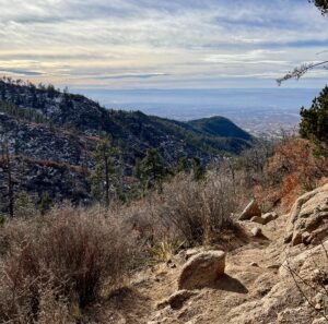
“Another switchback…how wonderful!” I wheezed out this sarcastic gasp as we neared the end of our hike up the Pino Trail to its connection with the Crest Trail in the Sandia Mountain Wilderness. Topping out at just shy of 10,000 feet, this trail is not for the weak-of-lung. My fellow sufferer Sara and I were in luck: calm winds, clear skies, and mild temperatures coaxed us higher and higher on this late December day.
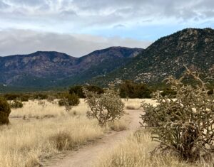
Originating in the Elena Gallegos Open Space at the eastern edge of Albuquerque, the Pino Trail is very popular. At its lower end it’s a very pleasant, gradual climb that rolls through pinon-juniper forest with killer views and interesting rock formations. There’s a neat historic marker sign at the start of the trail where one can learn about Doña Elena Gallegos (1680-1731). She was a daughter of early 17th-century Hispanic colonists, and married Santiago Gurulé, a “tattoed Frenchman.” Possibly ahead of her time, Elena Gallegos apparently had an appreciation for good body art.
The original land grant covered 70,000 acres, from the Rio Grande River all the way up to the crest of the western face of the Sandia Mountains…essentially the entire northern half of Albuquerque to the edge of Sandia Pueblo. Now only about 640 acres remain as the open space that still bears Elena’s name.
Starting at 6,500 feet, the Pino Trail heads east from the trailhead in Sims Park. As this is a developed facility, be prepared to pay for entry—a whopping $2 on weekends and $1 on weekdays. One of the great things about the Sandias is that about 30 minutes into most hikes, you often won’t see very many other folks. Solitude isn’t hard to find in these mountains. This always amazes me when hiking at the edge of a city of over half a million people. There is also wildlife to be seen: deer, bobcats, coyotes, mountain lions, reptiles, and many bird species call the Sandias home.
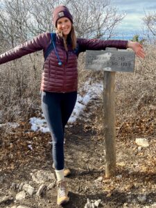
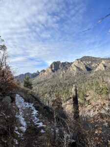
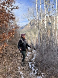
As the trail climbs higher, it passes through beautiful ponderosa pine forest and even some aspen groves. After about 5 miles of steady uphill hiking (including a steep section of switchbacks near the top), we managed to stumble out of the scrub oak to the trail intersection sign, celebrating the fact that there was no additional “up” to climb on the Pino Trail. Of course, we could have continued on up the Crest Trail, but we had maxed out our legs at that point. The return trip was much easier, and we had covered 10.1 miles by the time we returned to the trailhead.
Was it tough? You bet. I limped for two days afterward. Was it worth the work? Absolutely. Even if you go just a few miles at a lower elevation, the Pino Trail offers some of the best hiking and views in the Sandias.

