As the centuries-old cultures of Mesa Verde and Chaco collapsed in the late 1200s CE, the Ancestral Puebloan people moved out of the Four Corners region. They headed south and east in mass migrations that resulted in the birth of the Puebloan cultures along the Rio Grande in New Mexico where they continue to exist to this day in the towns of San Ildefonso, Ohkay Owingeh, Nambé, Zia, Jemez, and Santa Clara, among others. As they moved south, many of these migrants first made their way into the Jemez Mountains northwest of Santa Fe, building settlements such as those found at Bandelier National Monument. These were not the first people to enter the Jemez, however. Human habitation dates to at least 15,000 years ago and recent research is pushing that date even further back.
Born from the fires of ancient volcanoes, the Jemez Mountains began to form some 13 million years ago. This volcanism continued until relatively recently with the last major eruption barely one million years ago creating a hugely diverse geography of volcanic tuff, rhyolites, and obsidian---a fascinating landscape to explore.
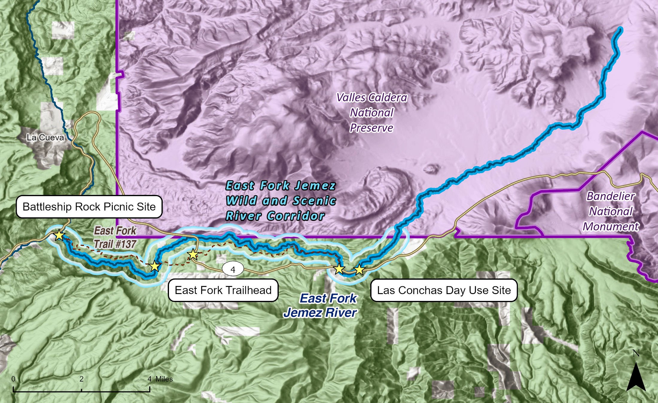
At the center of it all lies the Valles Caldera, a 14-mile-wide circular depression in the earth. The caldera was born around 1.2 million years ago after two massive volcanic eruptions launched some 100 cubic miles of material across the region—some of which has been found as far away as Kansas. After the second eruption, the volcano collapsed on itself, forming the caldera which then filled with water. At one time, the area resembled modern day Crater Lake in Oregon. However, erosion eventually took its toll, with the ancestor of the East Fork eating through the southwest rim of the caldera, draining the lake and carving the canyon below. While the caldera is dormant, it is far from extinct. Hot springs and active fumaroles can still be found throughout today's Valles Caldera National Preserve.
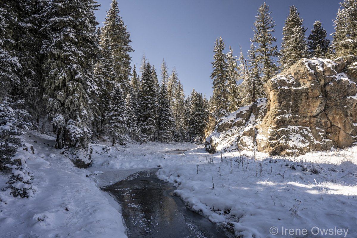
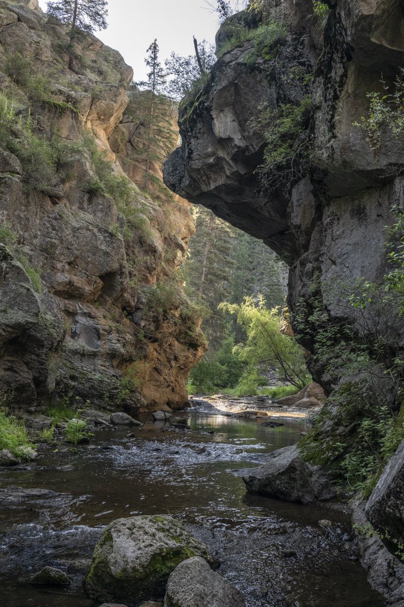
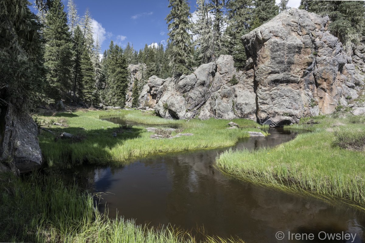
It is within this vast grassland that the East Fork of the Jemez River is born. The tiny rivulet wends its way through wet meadows surrounded by expansive views as it grows in size before tumbling through a rugged canyon dressed in thick forests of conifers. This stretch is full of dramatic cliffs and massive boulders and is impossible to traverse without wading or utilizing the footbridges placed along portions of the East Fork Trail by the Forest Service. Anglers frequently wade up the river into the box canyon in this area to access favorite fishing spots. But fishing isn't the only fun to be had along the river. The large boulders in the creek help to create deep pools popular among visitors for jumping, swimming, and tubing. In winter, this is a popular area for cross-country skiing.
The river rolls on, tumbling over the 70-foot-tall Jemez Falls and into another steep canyon with very limited access. Downstream of the falls lies the hard-to-miss Battleship Rock, a rhyolite mass dating to 85,000 years ago that towers over the canyon and the East Fork's confluence with the Rio San Antonio, which forms the Jemez River.
The Las Conchas Fishing Access is one popular recreation destination on the East Fork Jemez, located a short distance from the Las Conchas Trailhead at one end of the East Fork Trail. This portion of the trail closely follows the river for a mile, and its gentle grades and spectacular scenery make this a popular stretch for many recreation activities.
Historically, the East Fork of the Jemez was home to the largest population of Rio Grande cutthroat trout in the region. A high-quality cold-water fishery, the river also hosted Rio Grande chub, Rio Grande sucker, longnose dace and fathead minnow, all natives to this region. Today, the Rio Grande cutthroat trout is gone, replaced by non-natives such as brown and rainbow trout, incredibly popular with anglers. The dace and the minnow hang on in the lower reaches.
Thanks to the incredibly diverse landscapes, Jemez ecosystems support a variety of wildlife from bear, elk, deer, mountain lion, bobcat and coyote to swallows and American dippers bobbing from rock to rock as they hunt insects.
Several federally listed species also thrive in the Rio Jemez corridor, including the endangered Jemez Mountains salamander, the endangered New Mexico meadow jumping mouse, and the threatened Mexican spotted owl. The Northern goshawk, a Forest Service-designated sensitive species, also calls the area home.
The East Fork of the Rio Jemez is one of only four rivers in New Mexico named as wild and scenic rivers. The national Wild and Scenic River System was created by Congress in 1968, calling for certain rivers with outstanding natural, cultural, and recreational values to be "preserved in free-flowing condition, and that they and their immediate environments shall be protected for the benefit and enjoyment of present and future generations." An 11-mile section was designated as wild and scenic in 1990, from the Valles Caldera-Santa Fe National Forest boundary to its confluence with San Antonio Creek at Battleship Rock. The headwaters of the East Fork Jemez within Valles Caldera National Preserve remain unprotected under the Wild and Scenic Rivers Act.