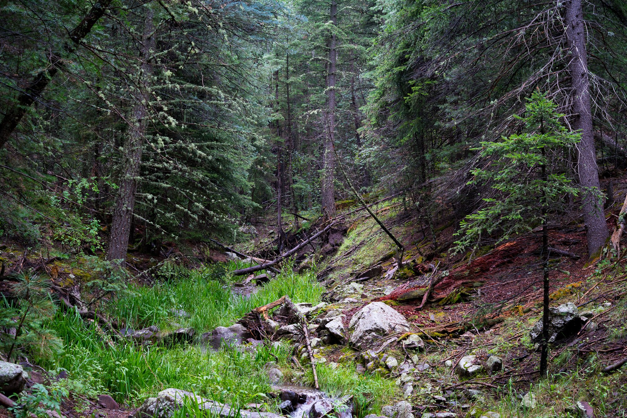
McKnight Canyon is part of the headwaters of the Mimbres River. The free-flowing East Fork of the Mimbres makes its way through the sheltering old-growth forests and wildflower-filled meadows of McKnight Canyon about 60 miles north of Deming. In the upper reaches of the East Fork Mimbres, mixed conifer forests intersperse with small stands of aspen while the banks of the creek support healthy riparian forests.
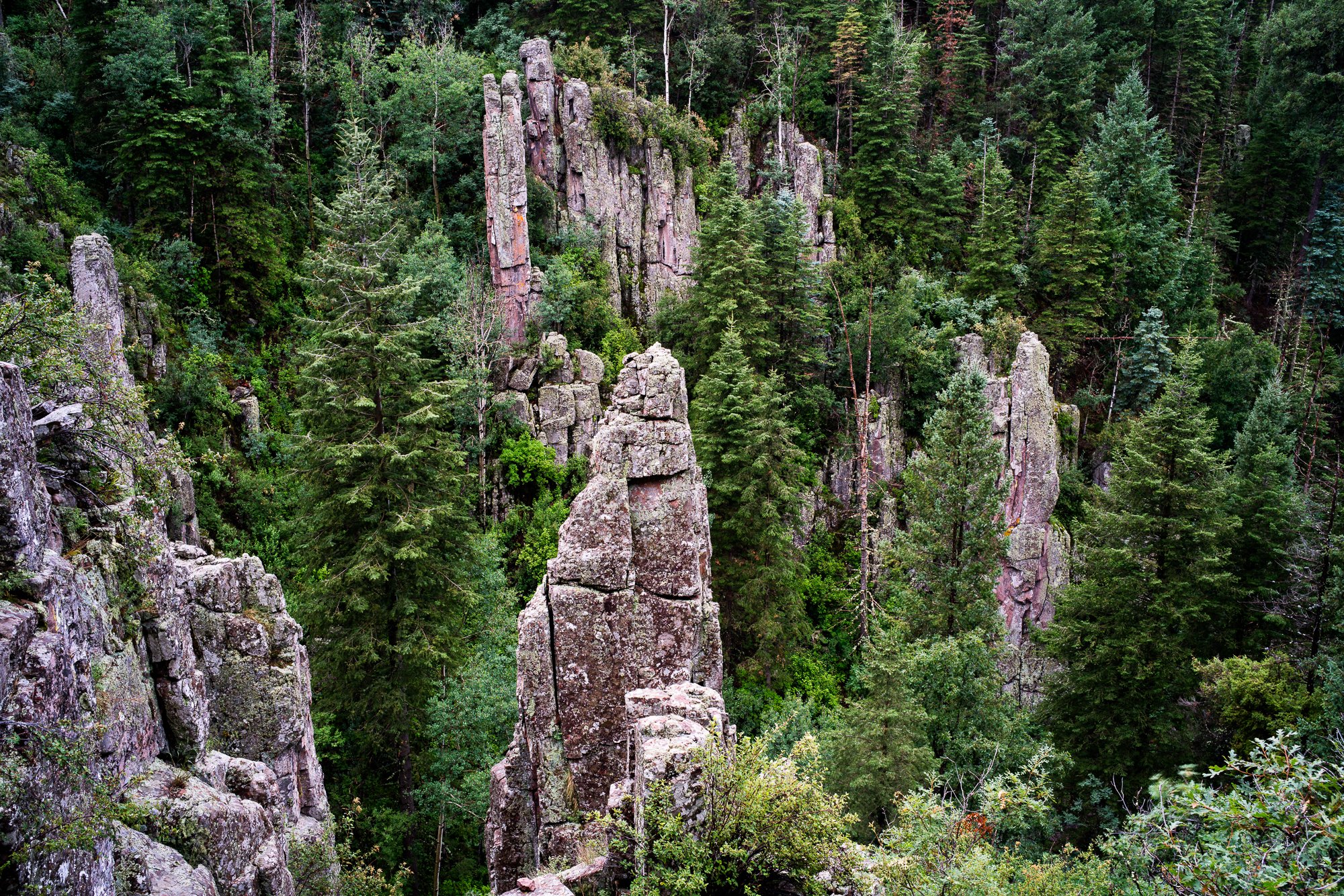
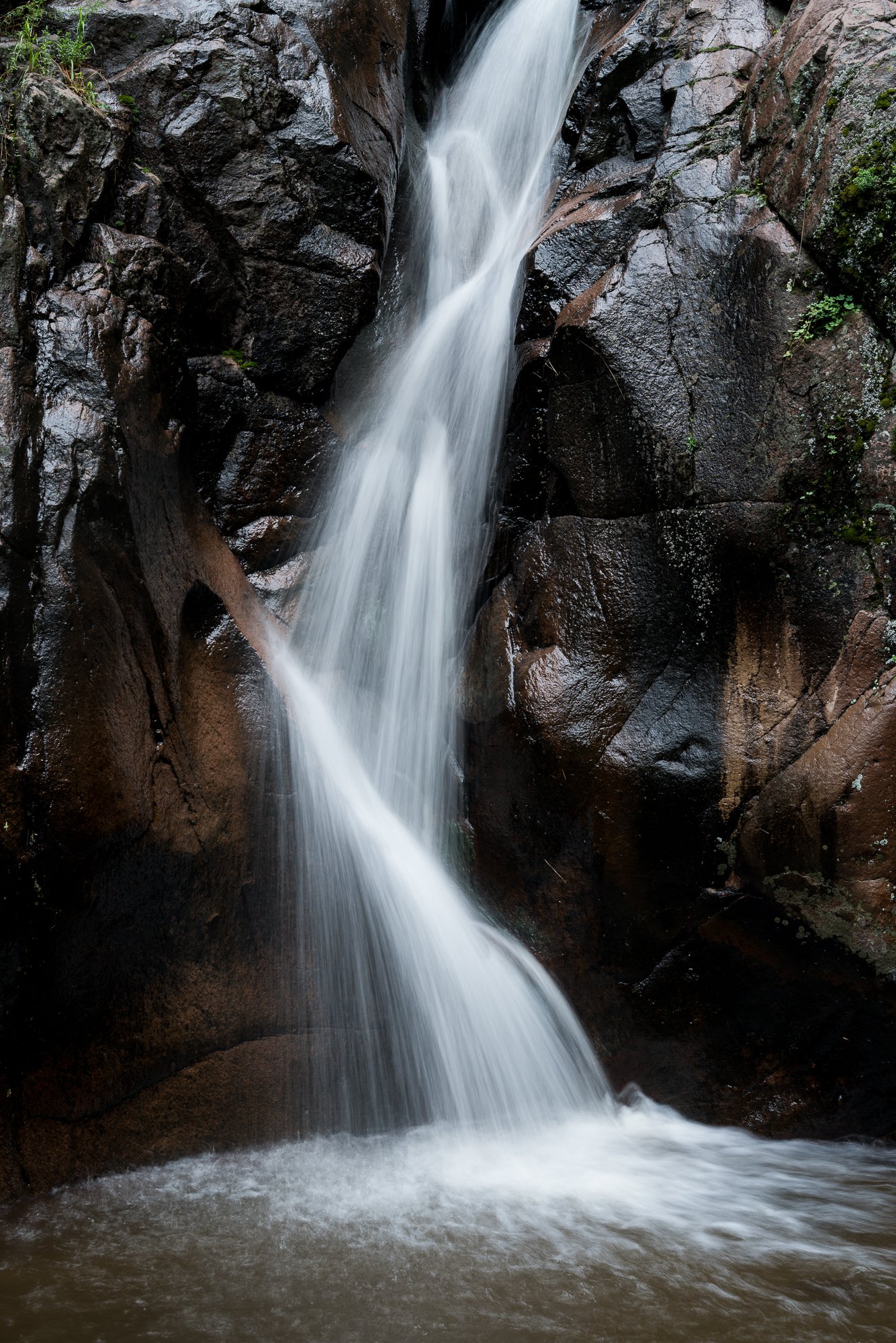
Fed by annual snowpack and high elevation springs, the East Fork Mimbres winds through steep and narrow McKnight Canyon with some sections of the run reaching nearly 900 feet deep. The canyon is part of an ancient and widespread volcanic field some 40 million years in age and is renowned for its waterfalls and deep pools among the canyon's dark volcanic rock.
McKnight sports incredible habitat diversity which in turn makes the canyon home to a wide range of flora and fauna, including outstanding and extensive stands of ponderosa pine forests. The fact that McKnight is adjacent to one of the largest designated wilderness areas in New Mexico enhances this prime habitat for wildlife populations of all types.
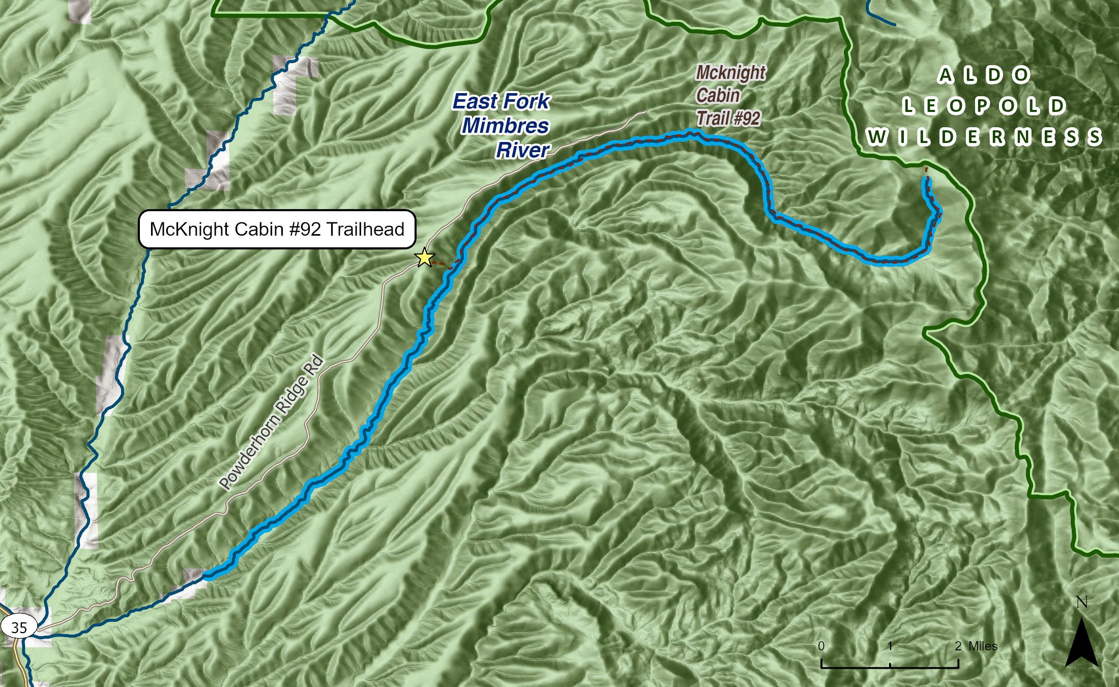
McKnight Canyon is ideal for hiking, camping, backpacking, bird watching, and waterplay. The McKnight Cabin Trail, No. 92, is an excellent way to access and explore some of the most spectacular sections of the canyon.