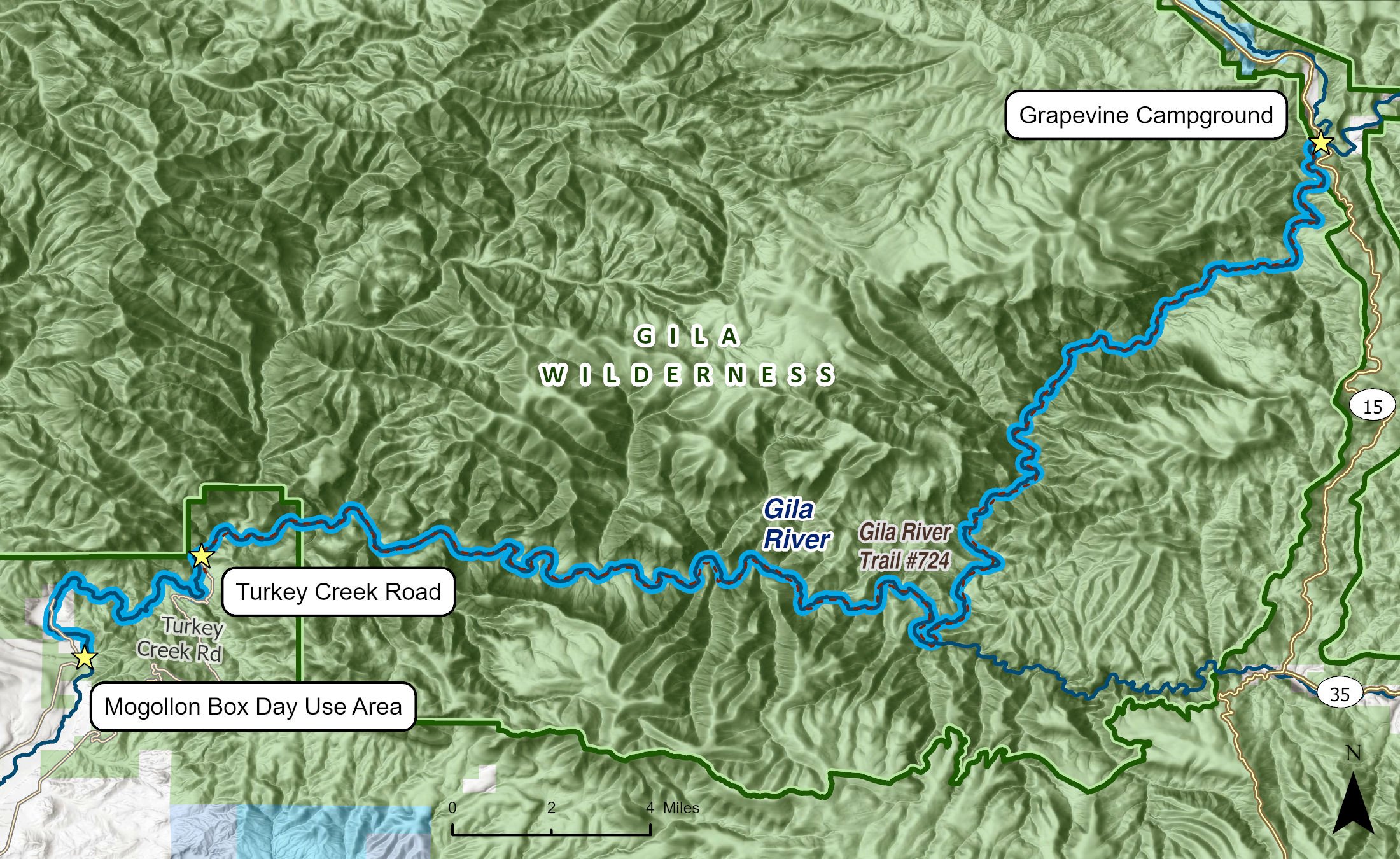
The Gila River's Wilderness Run is the convergence of the Gila Headwaters and originates near Gila Cliff Dwellings National Monument, just downstream of the confluence of the Gila's East, Middle, and West Forks. The Wilderness Run flows for 42 miles through and out of the Gila Wilderness, concluding at the Gila's confluence with Mogollon Creek, where the river becomes gentler and flattens out as it meanders into the Cliff-Gila Valley downstream.
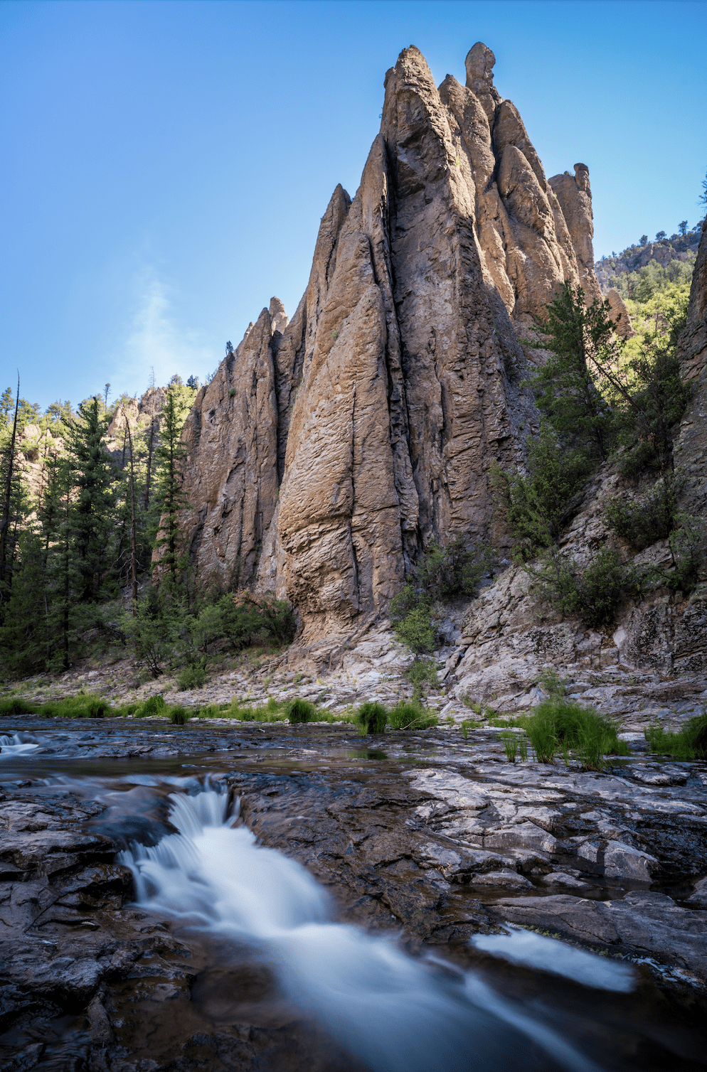
The biologically and culturally astounding landscape throughout the Gila Wilderness and along the Wilderness Run was formed through volcanic activity beginning 65 million years ago and subsequent, cataclysmic volcanic eruptions occurring between 20 million and 35 million years ago that created at least four huge calderas—geologic formations that are created when empty magma chambers collapse following large volcanic eruptions. Over the millions of intervening years, the Gila River and its tributaries carved deeply through the landscape, leaving jumbles of sheer rock cliffs and mountainous rolling peaks filled with mysterious chasms, rock towers, hoodoos, ash flows, caves, waterfalls, and vertical slabs of Gila conglomerate that soar above the Wilderness Run.
The Gila Headwaters are a key linkage between the Rocky Mountains and Mexico's Sierra Madre in the so-called Spine of the Continent Wildway that stretches from Mexico to the Yukon. This—along with its perch between the Sonoran and Chihuahuan Deserts; the Gila's incredible variation in elevation due to a tortured topography of rugged mountains, plateaus, and deep canyons; and the Gila River's unconstrained, free-flowing, and wild character—create a rich tapestry of habitat for rare wildlife and plant species, some of which are found nowhere else on the planet.
Indeed, 14 native fish species live in the Gila Headwaters, including three—the desert sucker, spikedace, and Gila trout—that have exceedingly limited habitat outside of the Gila. Riparian areas along the Wilderness Run and throughout the Gila Headwaters also harbor some of the greatest non-coastal breeding bird diversity and density in the United States. Broader landscape-scale habitat diversity, of which the Gila's riparian areas are central, support populations of federally listed species, including the Southwestern willow flycatcher, yellow-billed cuckoo, northern Mexican garter snake, narrow-headed garter snake, Chiricahua leopard frog, and Mexican gray wolf.
Humans have also thrived in this landscape for tens of thousands of years. Evidence of prehistoric Mogollon and Apache cultures, including pictographs, petroglyphs, cliff dwellings, granaries, and pottery are abundant to the discerning eye along the Wilderness Run and throughout the Gila Headwaters. Later, Spaniards, Mexicans, ranchers, and prospectors came to the area. The notable Apache chiefs Mangas Coloradas, Geronimo, and Victorio; influential early conservationist, author, and progenitor of wilderness protections Aldo Leopold; notorious hunter and mountain man Ben Lilly; and other noteworthy characters undoubtedly traversed the Wilderness Run during their days in the Gila and had outsized roles in shaping the history of the region.
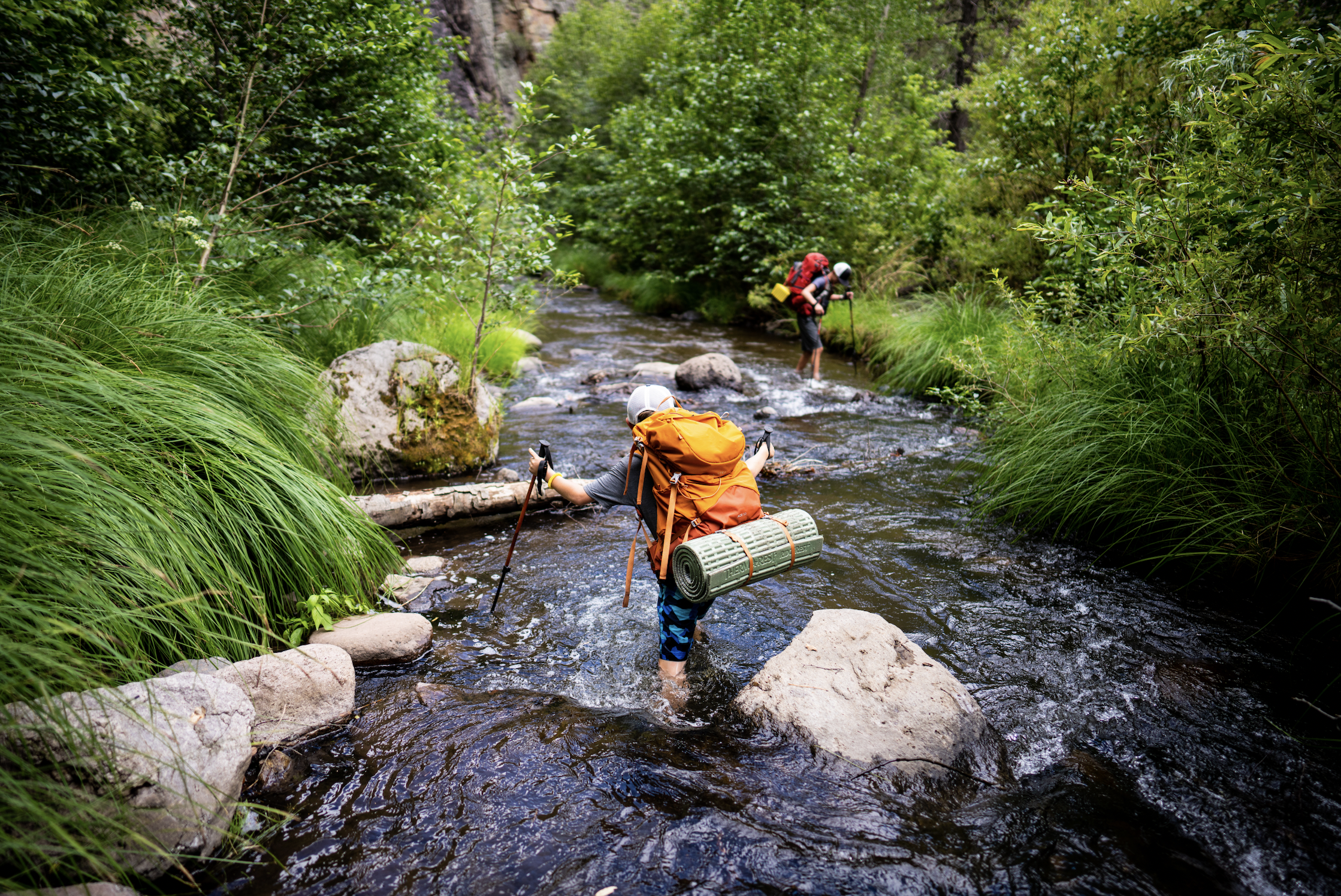
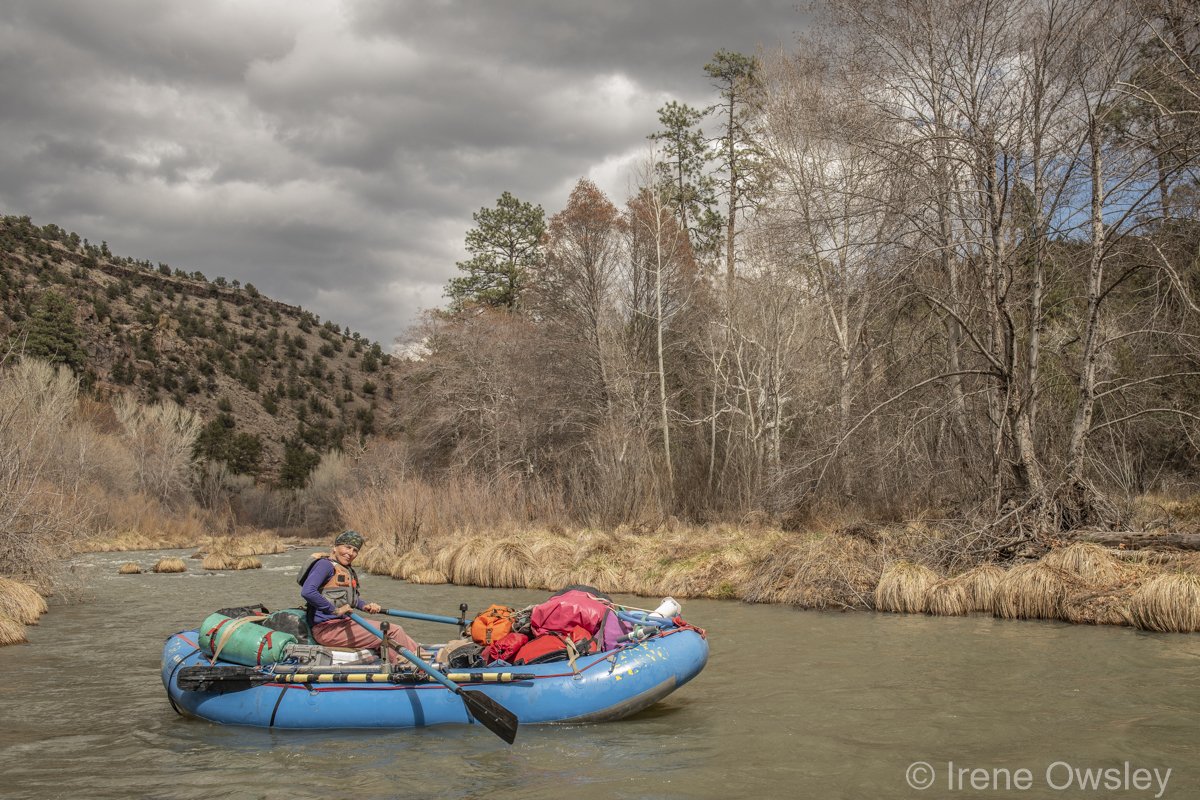
Today, people are likewise drawn to the Wilderness Run to seek solitude, adventure, awe, and inspiration. When the Gila River's flows rise due to snowmelt or monsoonal events, the Wilderness Run is sought after by skilled boaters equipped to navigate its many hazards, which include extremely remote and rugged terrain that makes rescue and evacuation difficult. It is also a truly wild river that can experience sudden and major flood events and is notorious for the many downed trees, known as "strainers," which constitute an entrapment hazard and must be avoided. During the much more common periods of low flows, the Wilderness Run is a destination for hikers, backpackers, and equestrians. In general, the river is only boatable during late winter and early spring flows and when monsoon rains create short-lived late summer flows.
Grapevine Campground marks the start of this river segment, and several other campgrounds are available in the area. Dispersed camping may also be available in the vicinity and near the Mogollon Box Day Use Area that marks the end of the river segment. Several hiking trails cross this segment of the Gila River, and the Gila River Trail, No. 724, follows the entire river segment and is accessible at lower flows.
The many side canyons that feed the Wilderness Run are seldom seen and rarely explored. While an occasional trout may make its way down from a cooler, upstream tributary, for the angler, catfish and bass are the name of the game.
Although the Wilderness Run exists in the heart of the Gila Wilderness, it and other prized segments of the river have been threatened by at least four major dam and diversion proposals since the 1960s. The Hooker Dam, authorized by Congress in 1968 and later defunded due to fierce community opposition, would have flooded the Wilderness Run as far upriver into the Gila Wilderness as the confluence of Sapillo Creek. Much more recently, the proposed Gila River Diversion under the Arizona Water Settlements Act would have directly impacted the lower reaches of the Wilderness Run and was only defeated in 2020 thanks to efforts by New Mexico Wild, other conservationists and community members standing up once again for the Gila River.