In the 1880s, prospector, miner, and mountain man George Beatty built a cabin in a meadow with a broad view of the Rio Pecos. Beatty was not alone. Countless individuals, hoping to get rich panning gold along the Pecos and its tributaries, flooded the area. Other European and Hispanic settlers arrived in the region throughout the 18th and 19th centuries, seeking wealth by exploiting the rich Pecos ecosystem for timber, furs, and later, intensive cattle grazing.
These were not the first people to come to the region, of course. Indigenous Americans had made use of the river's abundant resources since the end of the last glaciation. Puebloan people hunted, fished, and gathered herbs along the Pecos and irrigated crops with its waters. In time, they constructed Pecos Pueblo, one of the largest trading centers along the front range of the Sangre de Cristo Mountains. The river remains sacred to Indigenous nations, and the entire watershed is filled with sacred sites still visited by individuals and families from the Pecos, Jemez, and Tesuque Pueblos. The name "Pecos" derives from a Spanish language derivative of the Indigenous Towa term for the Pecos waterway.
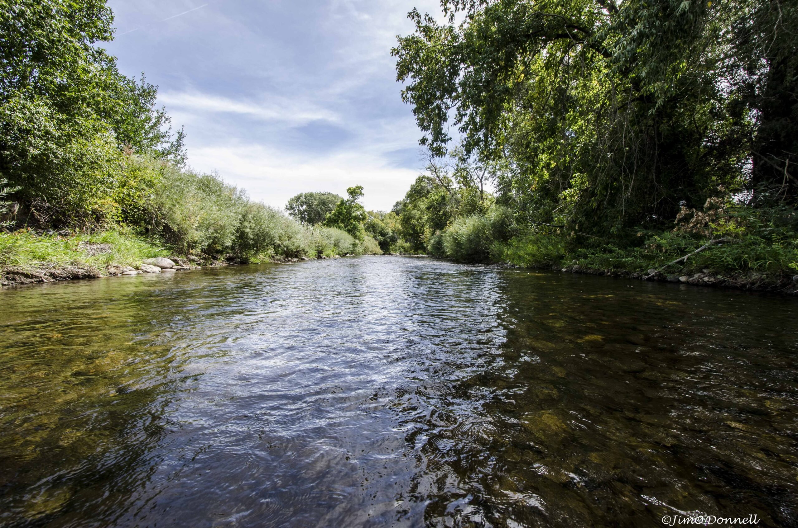
Today, the Pecos River is a high-quality cold-water stream ideal for anglers and a source of drinking and irrigation water for downstream communities.
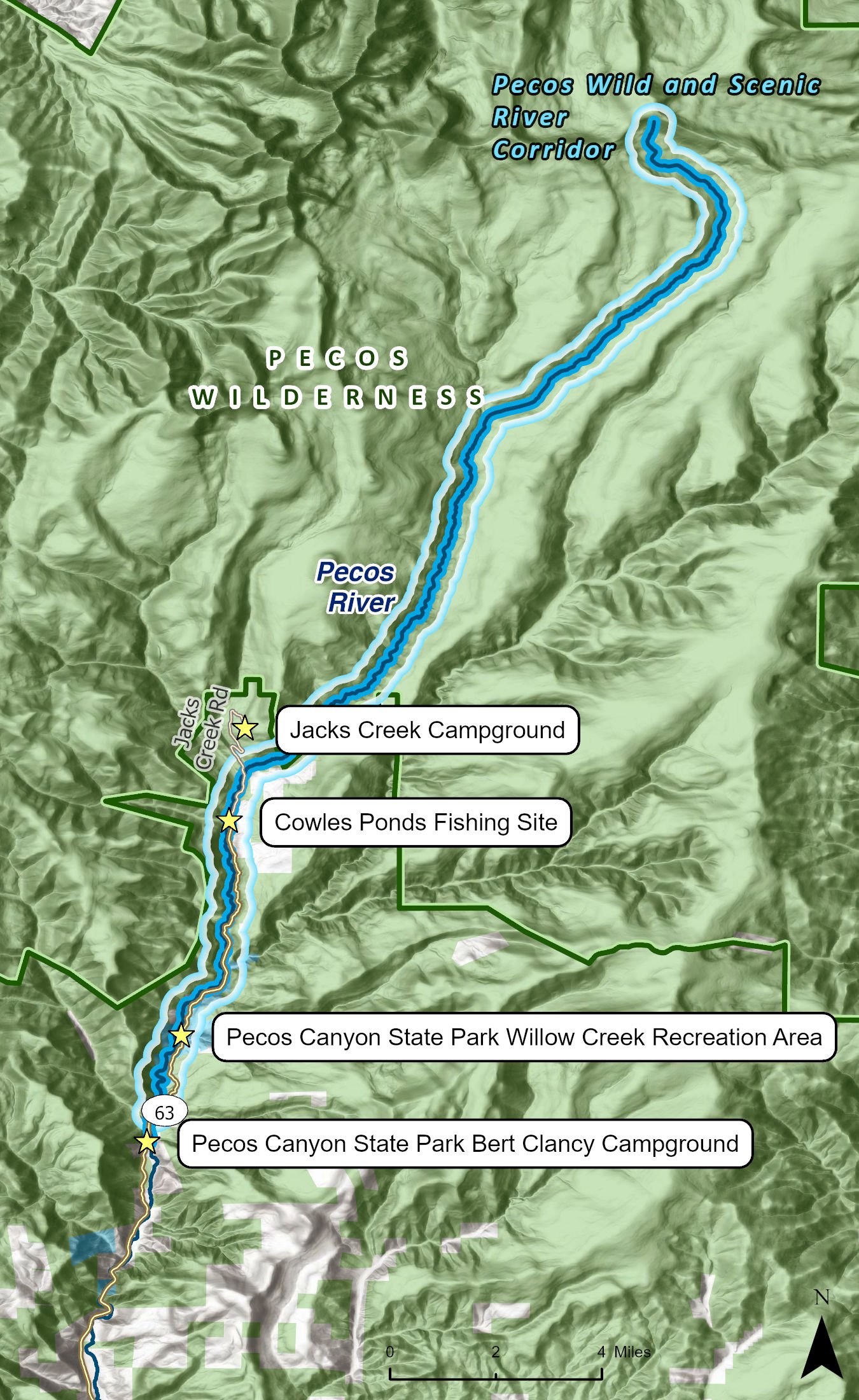
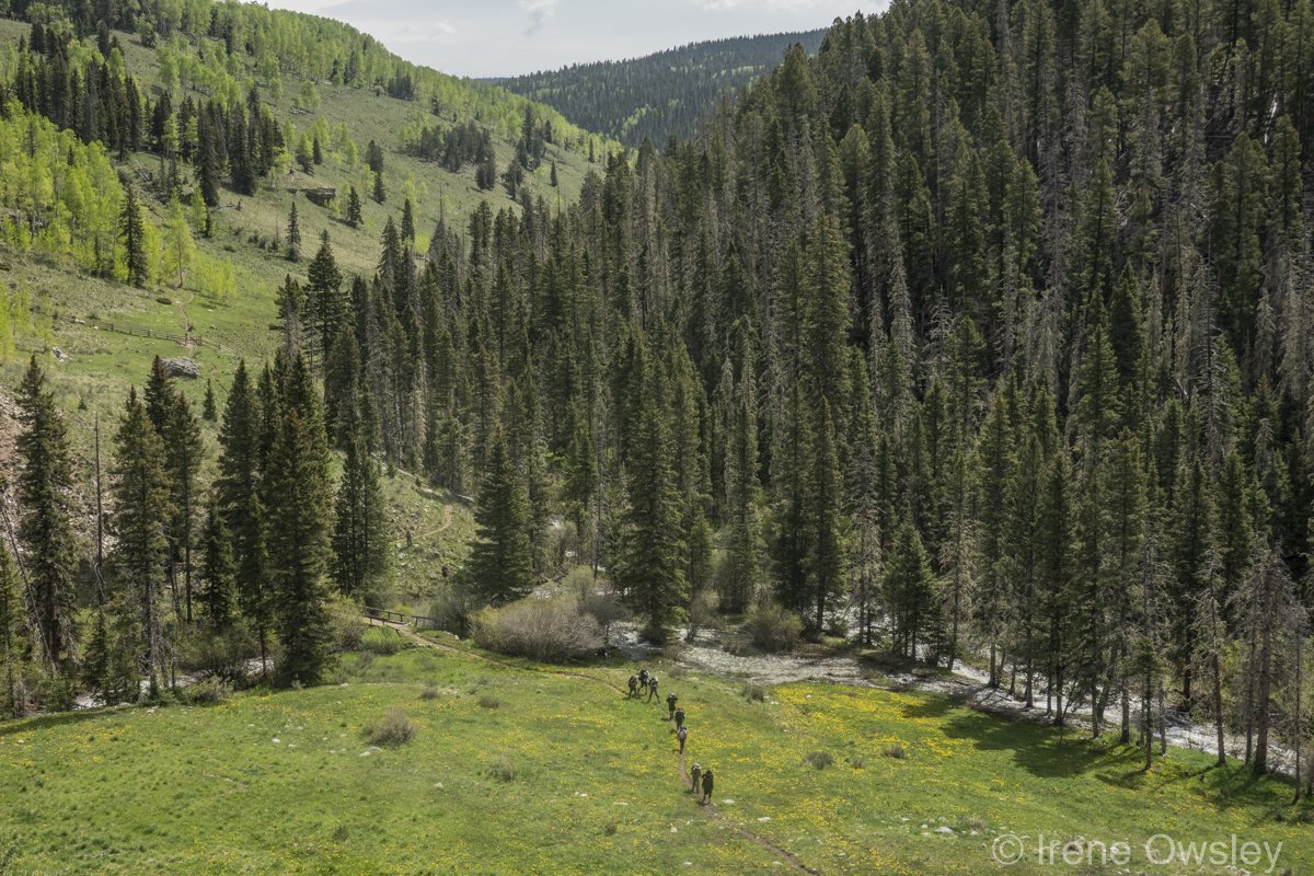
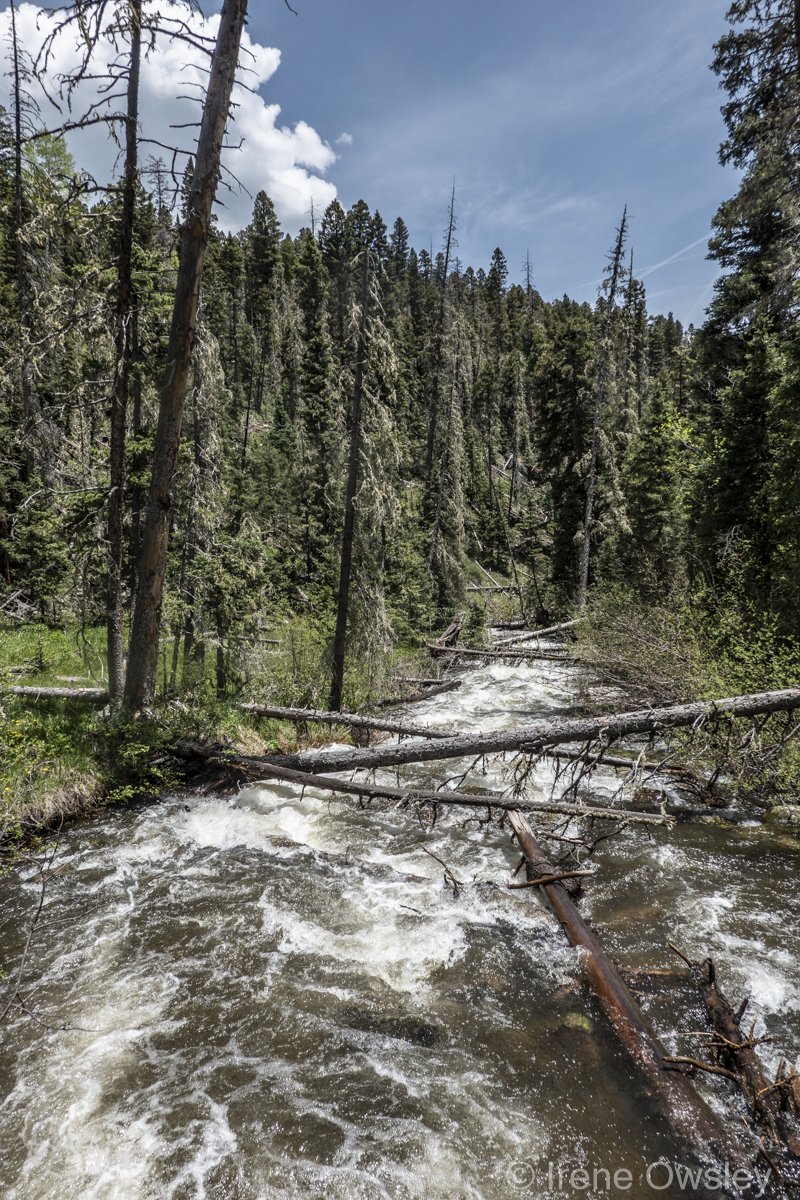
The Rio Pecos is born at over 12,000 feet in the spring-fed meadows of the Pecos Wilderness, one of the largest designated wilderness areas in the Southwest. The river traverses wildflower-studded high mountain meadows, rugged canyons and waterfalls, churning eddies, and shallow rapids. The headwaters reaches of the Pecos are blanketed in pine, fir, and spruce forests dotted with stands of bright aspen, golden in autumn. The landscape is dramatic with soaring cliffs, rock ledges, and from high points above the river, expansive views onto the Great Plains.
The upper Pecos flows through narrow, winding valleys and canyons of 300 million-year-old shales, sandstone, limestone, granite, quartzite, and schist.
These upper reaches are considered a stronghold for New Mexico's native Rio Grande cutthroat trout, designated by the Forest Service a sensitive species. These alpine meadows and forests are also home to the nation's southernmost populations of ptarmigan, the threatened Mexican spotted owl, and northern goshawk as well as elk, deer, black bear, mountain lion, and turkey.
This wilderness reach offers visitors boundless options for solitude, backpacking, hiking, and primitive activities and can only be reached via hiking trail.
Outside the wilderness boundary, the Rio Pecos has long been a recreational destination for locals and visitors alike. Here the river is accessible by vehicle, and numerous privately owned cabins dot the riverbanks. Popular activities include hiking, camping, picnicking, backpacking, horseback riding, bird watching, hunting, fishing, water play, photography, and sightseeing. Paddling is challenging as the river canyon can be extremely rugged and difficult to access but it is possible, particularly in May when the water is highest.
Several private landowners have illegally blocked access for tubes and kayaks by placing wire or other obstructions across the flow of the river. These can be very dangerous and should be reported to local law enforcement, the New Mexico Department of Game and Fish, and the New Mexico Attorney General.
In 1990, Congress, recognizing the priceless values inherent in the Pecos, designated 20.5 miles of the free-flowing upper reaches as wild and scenic.
Downstream, the village of Pecos and other nearby communities rely on recreational tourist spending for a significant portion of their income. The Pecos River is also the main source of irrigation water for traditional agricultural practices that continue to sustain many families within the watershed.
In 2019, a Colorado-based subsidiary of a massive Australian mining company purchased mining claims on lands surrounding the Pecos River and its tributaries in the Santa Fe National Forest. Now with over 236 mining claims, the proposed mining project would negatively impact more than 5,000 acres within the upper Pecos watershed and along five of its tributaries.
While mining is nothing new in the area—the Terrero Mine and mill produced zinc and lead from 1927 to 1939—these operations resulted in poisoned waters, destroyed livelihoods, and harms to the health of area residents. The Pueblo of Pecos was abandoned in 1938 because the river was too poisoned with heavy metals to sustain the community. The later collapse of a tailings pile killed thousands of trout in the Pecos. The area was later declared a Superfund site to prioritize these contaminants for cleanup.
Recently, farmers, anglers, community members, and water advocates joined New Mexico Wild to create the Stop Terrero Mine Coalition to respond to the mine proposal and prevent future impacts to the river from mining.