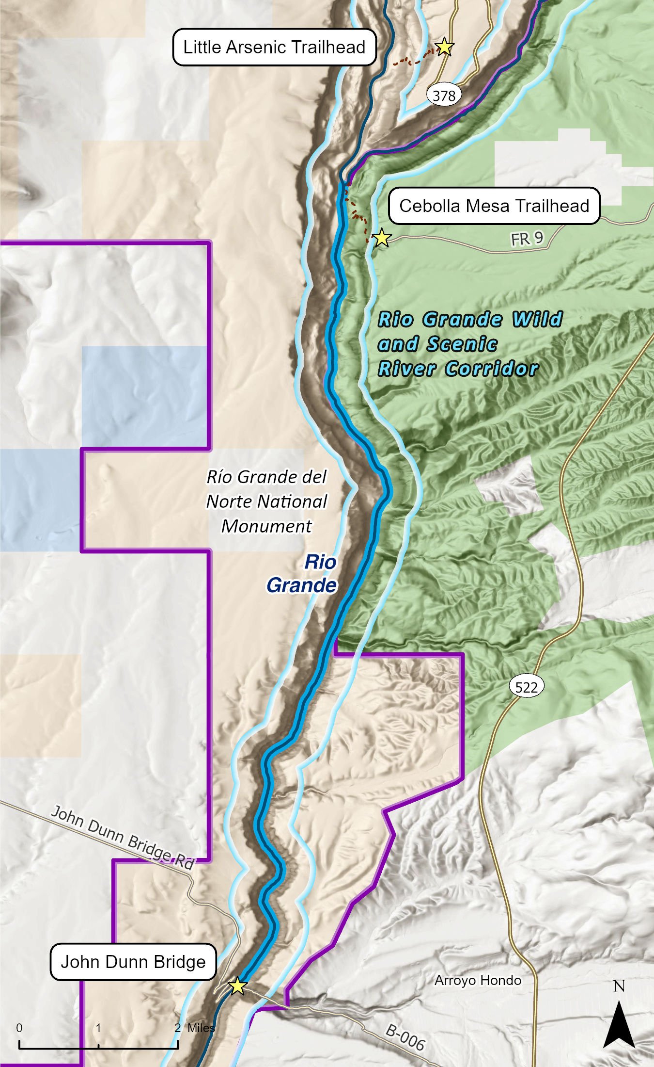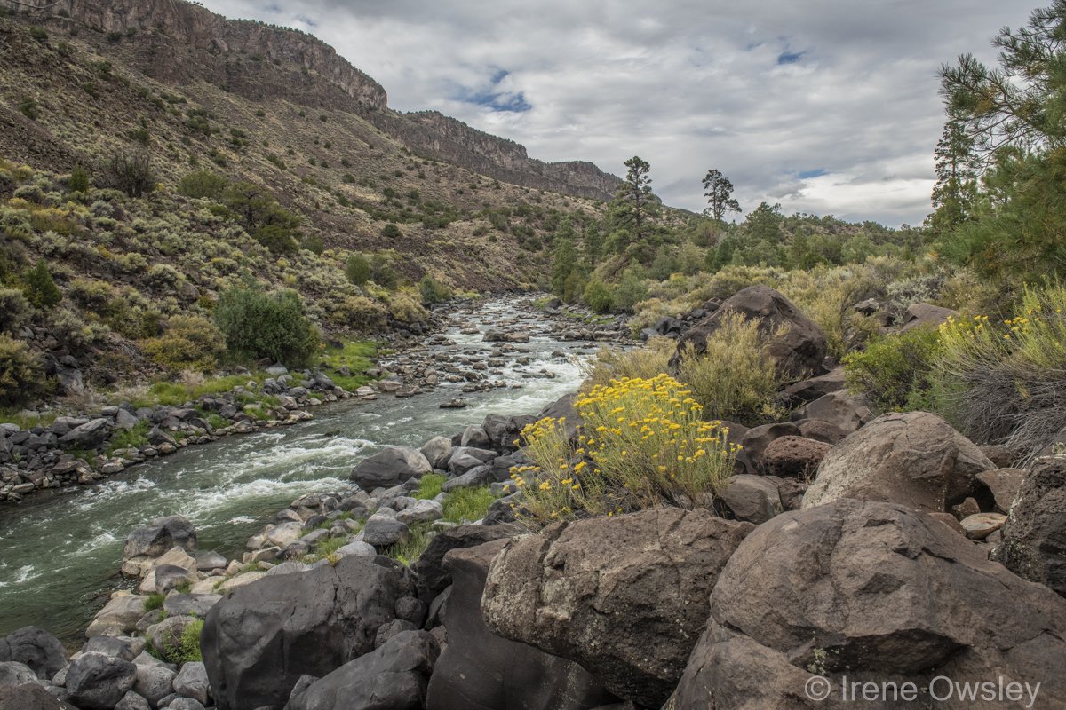
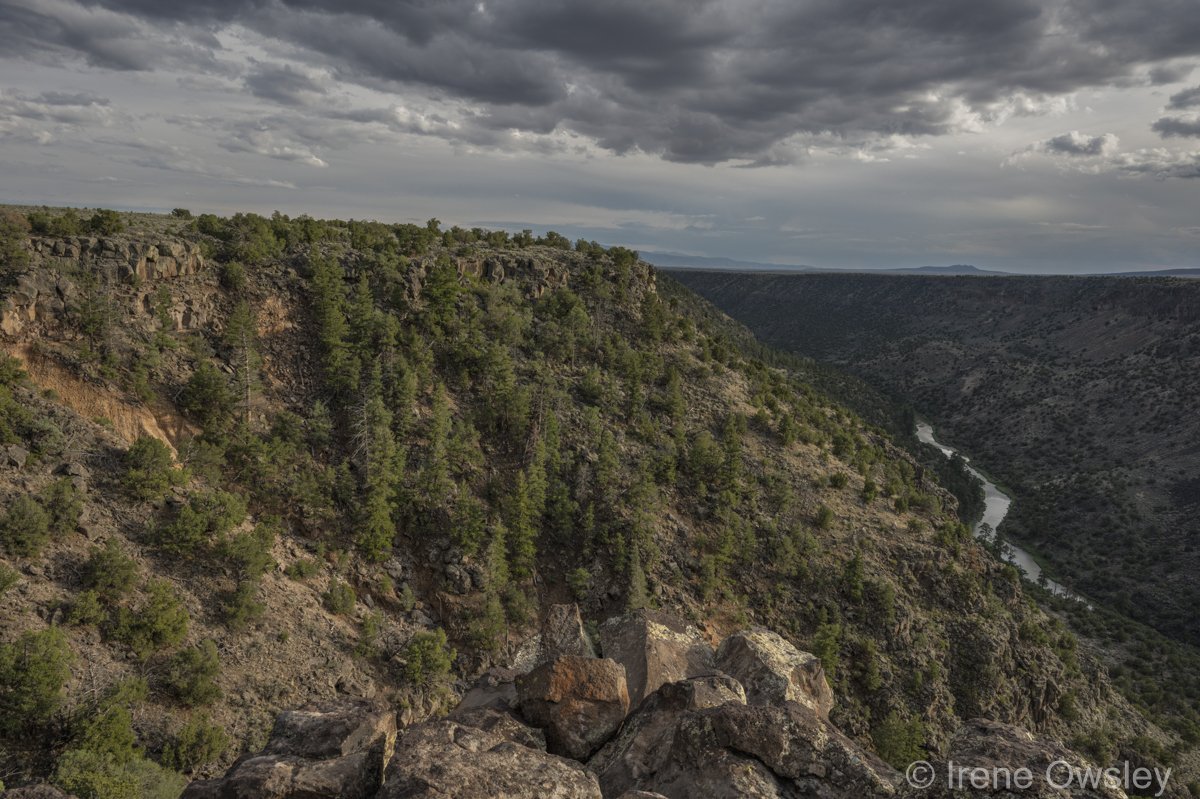
The La Junta or Middle Box section of the Rio Grande Gorge is a relatively mellow 9.6-mile reach between Little Arsenic Spring and John Dunn Bridge. While the hair-raising Upper Box and the better known—and equally as wild—Lower Box demand expert-level skills to traverse, the Middle Box is perfect for canoes, kayaks, and rafts for those with intermediate whitewater skills. In many spots it can be floated with an innertube. Sheer-walled canyons tumble to willow-filled riparian bottoms, piñon-juniper woodlands, and towering ponderosa pine.
There are three possible put-ins, all accessed by an approximately 1 mile descent into the gorge. The Little Arsenic Springs Trail is both the most northerly and most reliable put-in as the road is paved right up to the trailhead. Cebolla Mesa and Miners Trail access are more challenging and can become impassable mud slogs during summer monsoons or late season snowmelt. The challenging logistics of getting down to the river mean that this section gets few visitors.
At the top of the stretch just below Little Arsenic, boaters will pass through a tunnel of impressively tall ponderosas before hitting a stretch of Class II and III rapids that can prove challenging during spring runoff. Later in the year, as water levels drop, these rapids become a phantasmal maze of boulders, pools, and eddies. Past Cebolla Mesa, the river flattens and, but for the occasional Class I, meanders calmly through the narrow gorge. This is rough and remote terrain—once past Cebolla Mesa and Miners Trail, exiting the canyon is nearly impossible, making rescue and evacuation extremely difficult. The most significant hazard boaters may face in this stretch is hypothermia as the Rio Grande can be very cold for most of the year.
Along this mellow stretch, opportunities to view river otters and bighorn sheep abound. Both species were reintroduced in the early 2000s and their numbers have thrived. This is also a good spot for petroglyphs, dozens of which appear on the canyon walls and then fade as you float past.
Numerous trails offer river access throughout the wild and scenic portion of this reach, and camping is available on the rim of the gorge and next to the Rio Grande at Little Arsenic Springs and La Junta. There are no public campgrounds available below Cebolla Mesa.