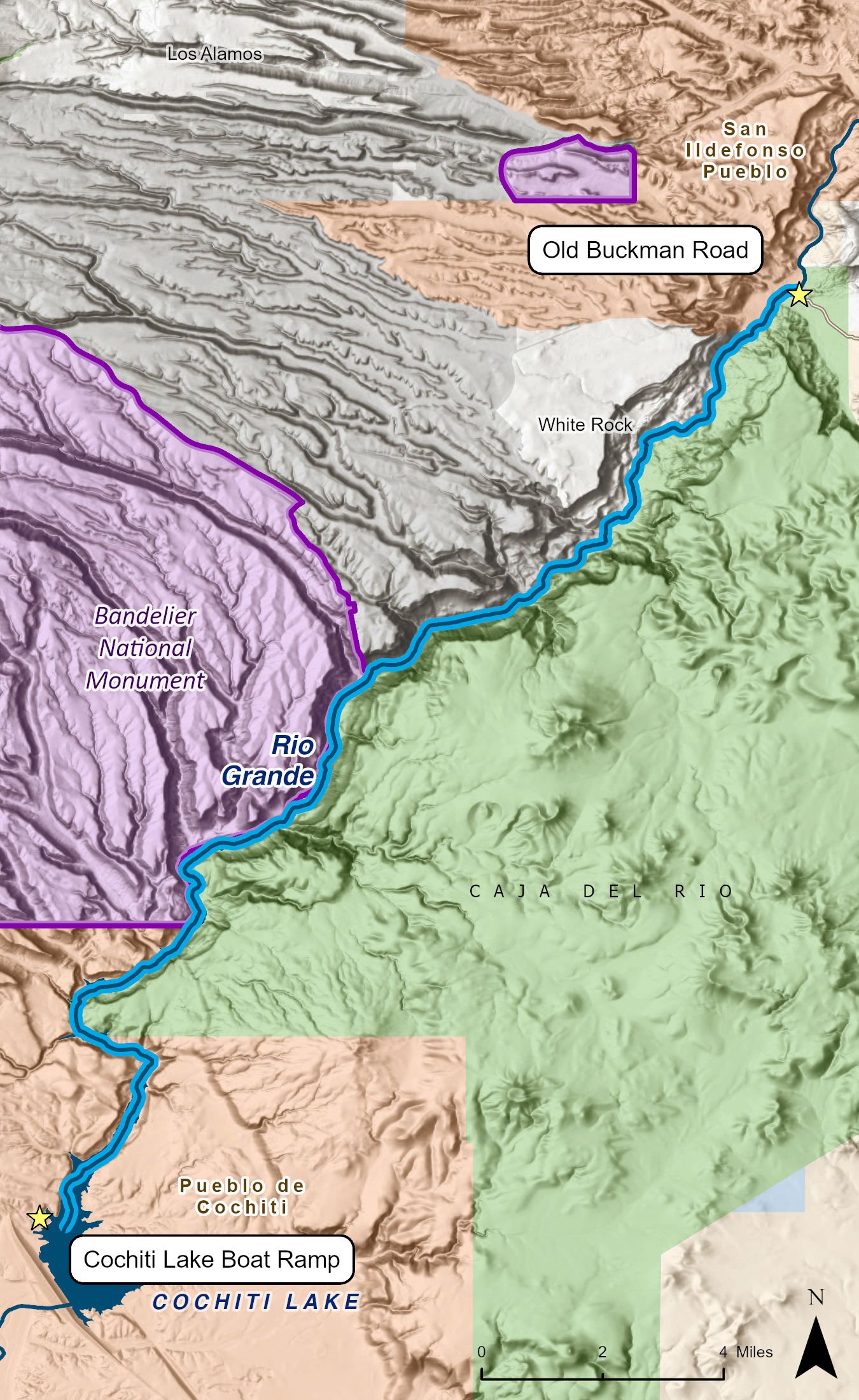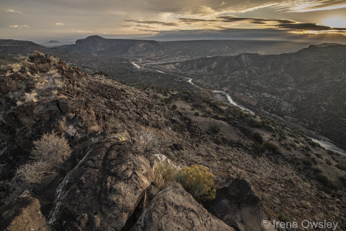
The White Rock Canyon stretch of the Rio Grande is a remote and difficult to access section of the river south of Los Alamos. That remoteness and difficulty make this one of the highlights of the whole river.
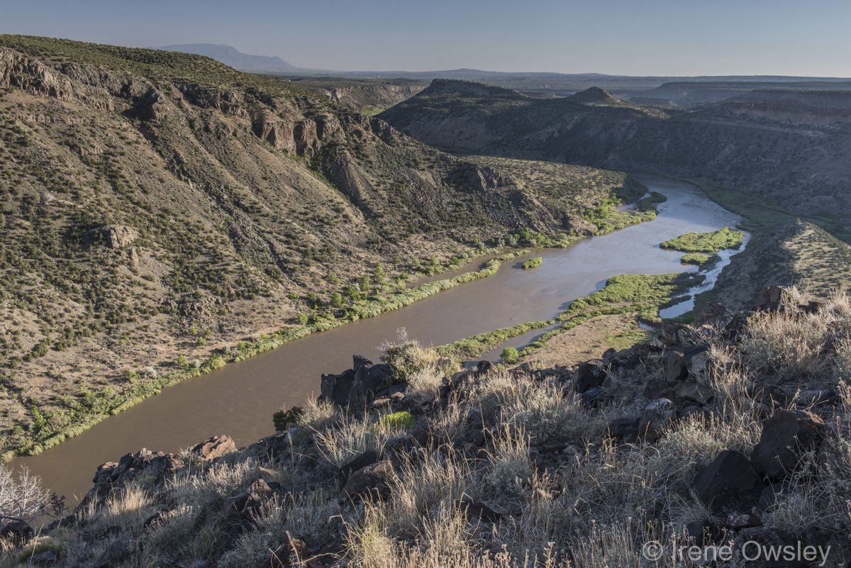
Rushing through sheer canyon walls towering upwards of 1,500 feet, the White Rock Canyon float is about 20 miles from Buckman Crossing to Cochiti Lake. The river passes through the lands of San Ildefonso and Cochiti Pueblos as well as the Santa Fe National Forest and Bandelier National Monument. The route is generally flat, punctuated by several Class I and II rapids and three Class III rapids that vary in intensity depending on the amount of water in the river.
White Rock Canyon was not always so remote. Seven hundred years ago, this canyon was home to a thriving civilization. Thus, the canyon is full of ancient petroglyphs and significant Ancestral Puebloan townsites. It also features geologic wonders and is teeming with wildlife.
The put-in for White Rock Canyon is at the Buckman Road Access (Buckman Crossing), and take-out is at Cochiti Lake. Be aware that the Buckman Crossing parking area is a well-known party spot, and numerous vehicles have been vandalized there through the years.
White Rock Canyon is typically a one-night trip but with proper planning it can be done in one long day. Two nights is ideal to take in this magnificent hunk of landscape.
Paddlers tend to look at this canyon in two sections—the first going from the put-in to about the 10-mile mark and the second reaching the take-out.
The first section is a light whitewater run of Class I and II rapids that build into the larger Class III rapids (again, depending on time of year and water level) named Water Canyon Rapid and Ancho Rapid. It is recommended to eddy out and scout both rapids before entering as varying water levels can make these runs quite the washing machine at times.
The minimum recommended flow for small paddle craft such as a kayak or SUP is 600 cfs. When the flow reaches 3,500-4,500 cfs, the rapids become quite meaty with large standing waves at Water Canyon.
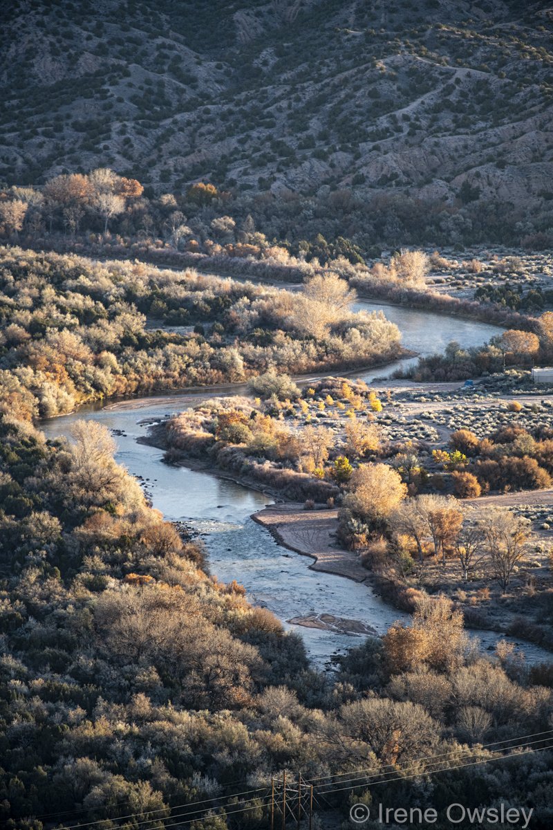
The second section is a more mellow yet swift float over a sandy and rocky riverbed braiding into a maze of lagoons, side channels, and shifting sand bars as you enter Cochiti Lake. When the lake is full, the last several miles can be slow going. Spring winds pushing upstream from the south can make getting across the lake quite difficult, so it is recommended to arrive at Cochiti in the morning if you are making the trip in the spring.
White Rock Canyon has few man-made obstacles. That said, keep an eye open for the occasional metal fence post as well as the hundreds of truck tires someone dumped into the canyon several decades ago. These are more of a problem during low water, and volunteers have been slowly removing the tires.
Through the canyon, the river flows between soaring walls of the dark volcanic basalt and amongst lighter layers of volcanic ash, tuff, and pumice that originated from the million-year-old volcano that is the center of the nearby Valles Caldera National Preserve. The high canyon walls, waterfalls, and caves rich with petroglyphs make White Rock Canyon a trip worth slow exploration with numerous side hikes.
White Rock Canyon also supports black bear, coyote, eagles, warblers, red wing blackbirds, and hawks.
Finding campsites can be challenging as the river is constantly shifting throughout the year. About 3.5 miles past Ancho Rapid, paddlers enter Bandelier National Monument on the right bank. A backcountry permit to camp is required. The opposite side of the river (left bank) is managed by the U.S. Forest Service, and no permits are required.
For the better part of this float, the Rio Grande runs along the 106,000-acre Caja del Rio plateau (river left), one of the most wildlife-rich and culturally significant landscapes in the state. The Caja (or box) is home to thousands of pre-colonial petroglyphs and remains a sacred landscape for Indigenous Americans to this day. It is also a critical wildlife migration corridor. New Mexico Wild is working to permanently protect the Caja del Rio for future generations.