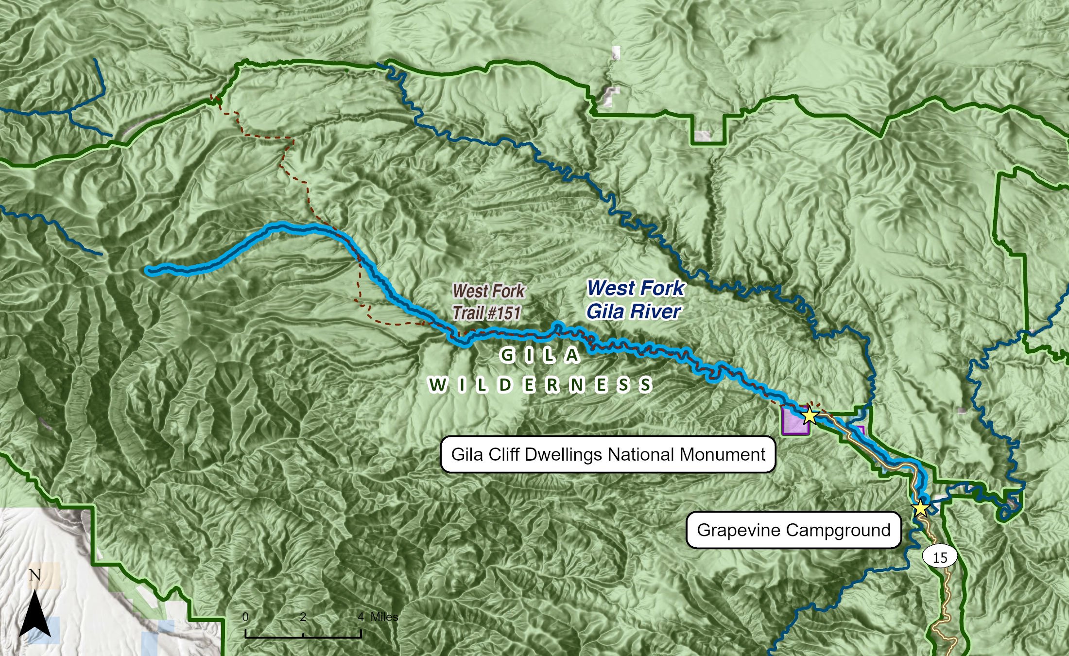
The West Fork of the Gila River descends 4,100 feet over the course of its 37-mile journey, from its headwaters just east of Center Baldy to its confluence with the East Fork of the Gila River. This segment is renowned for its stunning geology, outstanding prehistoric cultural resources, and the access that it provides to areas with an abundance of opportunities for solitude.
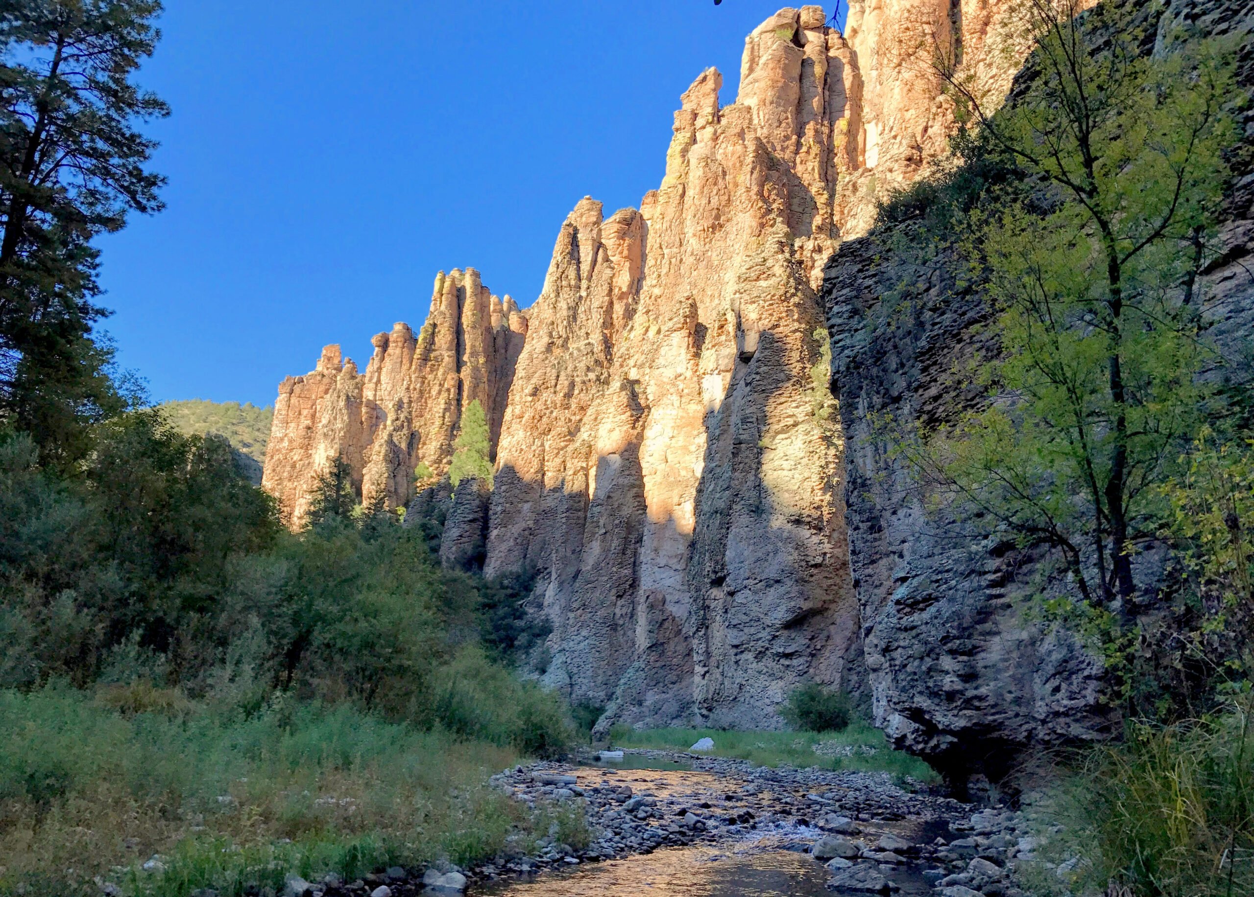
The so-called Gila Conglomerate dominates the geology of the area. The conglomerate is a cemented stew of volcanic tuff, basalt, andesite, rhyolite, sand, and gravels dating to the late Miocene and early Pleistocene epochs. Late Tertiary basalt caps mesas and spires throughout the area while lighter colored andesite marks ancient lava domes and flows. One of the reasons for the large number of rugged spires and cliffs along the West Fork is the extensive presence of rhyolite, another volcanic material that is resistant to weathering.
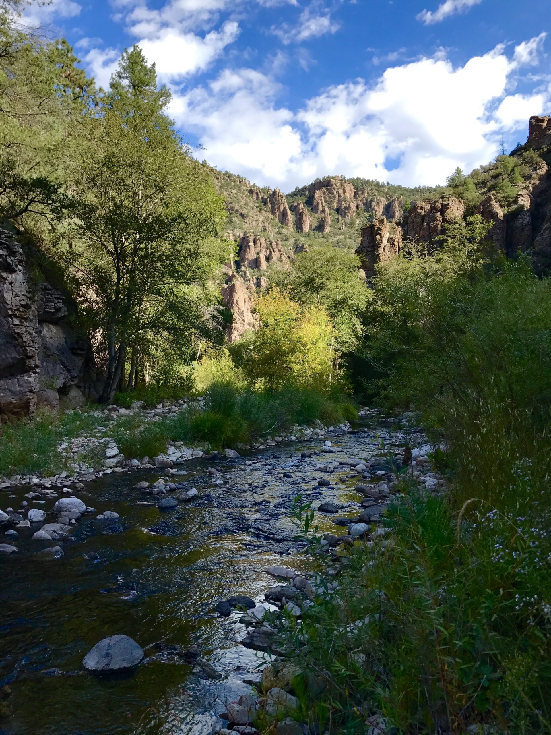
The West Fork of the Gila and other rivers and streams throughout the region have eroded through this volcanic material to form a network of iconic canyons. Thanks to the area's unique geology, the landscape along the river is nothing short of astounding. Carving its way through a geologic paradise of 800-foot-high rhyolite rock cliffs, packed volcanic layers, gnarly spires, pocket caves, smoothed slabs of Gila conglomerate, and hoodoo towers, the river canyon provides a colorful geologic tapestry that contrasts beautifully with the lush, green riparian ribbon below.
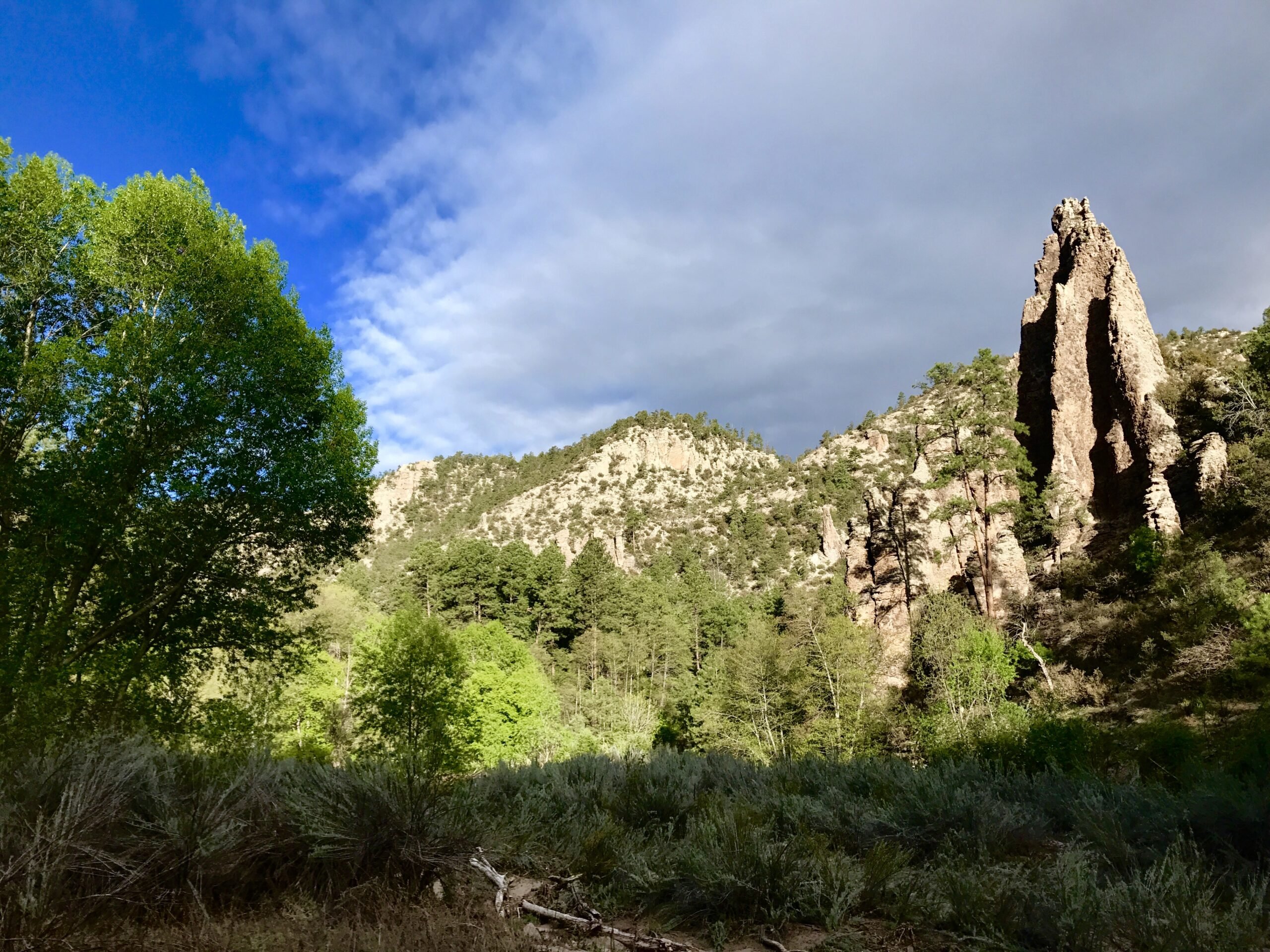
As the river wends and bends its way along its course, the canyon becomes increasingly twisted and contorted, broad in some areas with park-like meadows and narrow with sheer canyon walls in others. Along the West Fork, upland forests of ponderosa pine blend with juniper, cottonwoods, black walnut, box elder, alder, and willows, offering ideal habitat for a diverse array of wildlife species.
Long ago, Indigenous Americans inhabited this unique landscape. While the Gila Cliff Dwellings National Monument, located on the lower portion of the West Fork, is relatively well-known and was designated by President Theodore Roosevelt in 1907 to permanently protect its exemplary dwellings, more obscure are the cliff dwellings hidden in forest-covered canyon walls upstream of the national monument. These dwelling sites date to the 1270s according to tree-ring research and were part of the Mogollon culture which thrived in the region before moving on in the early 14th century. Numerous Apache and archaic cultural sites also exist along the West Fork.
To explore the West Fork, Trail 151 is the best option, tracing the river (with a multitude of river crossings) from the Gila Cliff Dwellings in the central region of the Gila Wilderness to Willow Creek on the north end of the wilderness.