The Chama River canyon has attracted human beings for 10,000 years or more. Utilizing the high-quality cherts of nearby Pedernal Peak and the ebony obsidian of the Jemez Mountains for hunting tools, Paleo and later Folsom peoples thrived along the banks of the Chama, leaving their mark on the canyon in the form of countless petroglyphs, grinding stones, and hunting sites. Later, Tewa people migrating from the Mesa Verde region constructed large communities along the Chama and its tributaries, including a regionally significant cultural and trade center inhabited from about 1000-1600 CE.
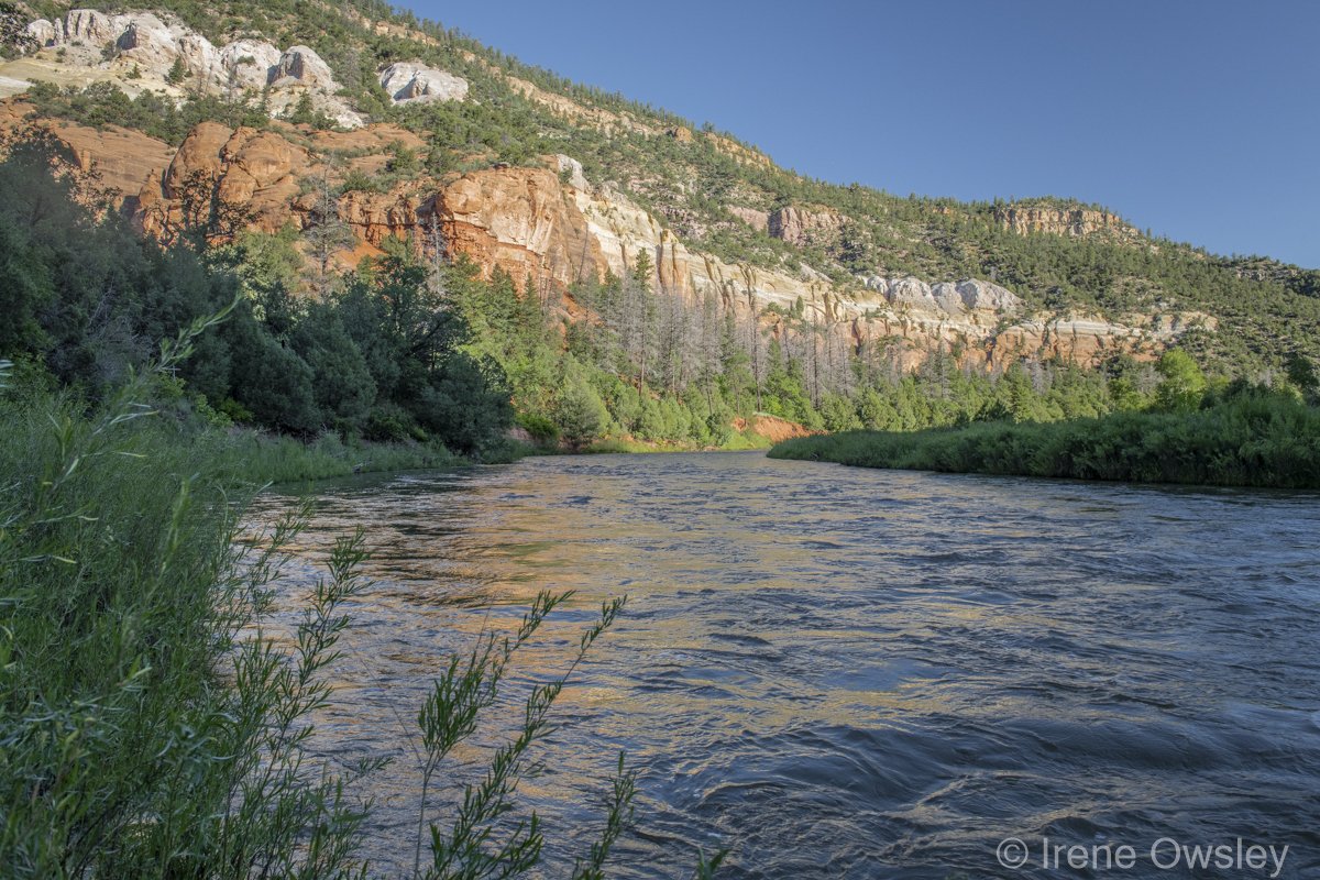
Floating the Chama is like taking a trip back through time. The 140-mile tributary of the Rio Grande, born along the Continental Divide in Colorado's San Juan Mountains, cuts a spectacular canyon through a rainbow of Mesozoic sedimentary layers, shale, basalts, granite, and gypsum outcrops dating to 110 million years ago. The Chama Canyon, 1,500-feet deep in places, also shelters the fossilized tracks of Allosaurus in a deeply wooded side canyon.
The aptly named Tiger Wall is known for its outstanding desert varnish---vertical stripes on sandstone cliffs---reminiscent here of tiger stripes. These markings are composed of clay particles rich in iron and manganese and are created by mineral rich waters running down the cliff face during storms, building up over centuries.
This geography makes the Chama Canyon a visual delight. An excellent place for photography, the canyons are also known to attract painters. Georgia O'Keeffe created many of her more well-known works in this area.
In the 1930s, the federal government and the state of New Mexico dammed the Chama to regulate seasonal flows and store water for downstream farmers. To this day, farming in the watershed has a significant impact on the river, with many of its tributaries diverted in whole or in part for small-scale agricultural operations in bottomland areas.
One of the main dams forms El Vado Reservoir, which is augmented with water from the San Juan River basin that is pumped under the Continental Divide to bring New Mexico its allotment of the Colorado River.
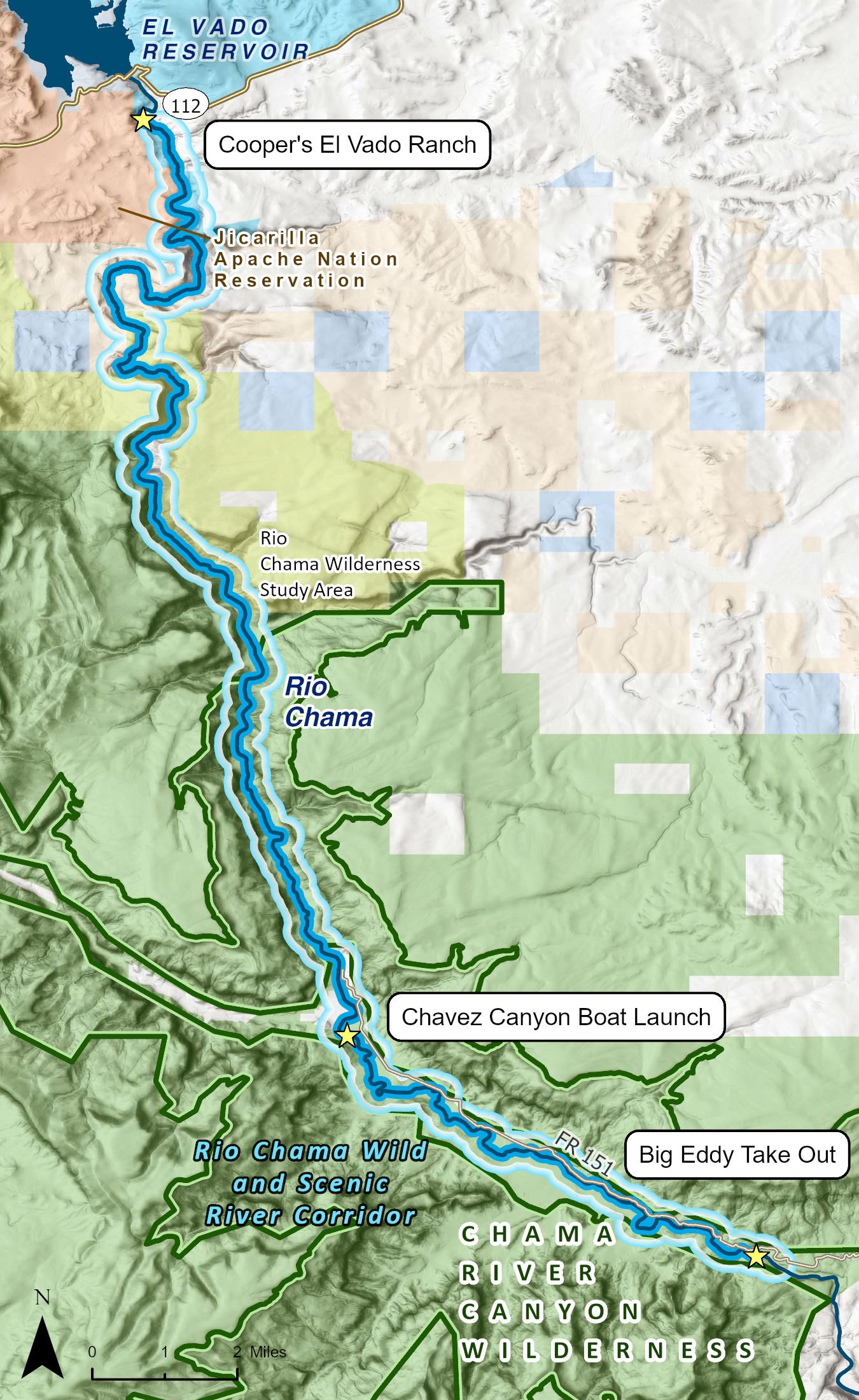
This stretch of the river is co-managed by the Bureau of Land Management (BLM) and the Forest Service. In 1988, Congress designated a 24.6-mile section of the river in the area known as Chama Canyon as a wild and scenic river, offering that section of the river the most important protections a free-flowing stream can have in the United States.
The Chama River Canyon Wilderness designation offers still more protection to the river as well as the uplands. The wilderness area encompasses over 47,000 acres of sagebrush flats and conifer and riparian forests.
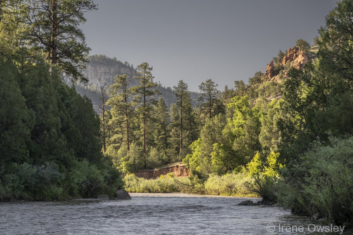
The Chama canyon shelters a rich ecosystem of ponderosa pine, Douglas fir, piñon, juniper, mountain mahogany, oak, currant, and serviceberry along the rim and a riparian forest of cottonwood, alder, willow, and hackberry below. These rich forests in turn support an array of wildlife from mountain lion and black bear to elk, mule deer, coyote, beaver, and racoon. Ducks, American dippers, bald and golden eagles, mergansers, heron, hawks, and owls all nest among the canyon's soaring sandstone cliffs.
These waters are likewise rich in aquatic life. The area is well known for sport fishing as large brown and rainbow trout abound. Native species include fathead chub, longnose dace, and catfish, among others.
The river truly offers something for everyone, including boating, fishing, hiking, bird watching, and solitude. Both the wilderness designation and the wild and scenic river designation ensure protection of this vital desert ecosystem filled with cultural resources and natural wonders.
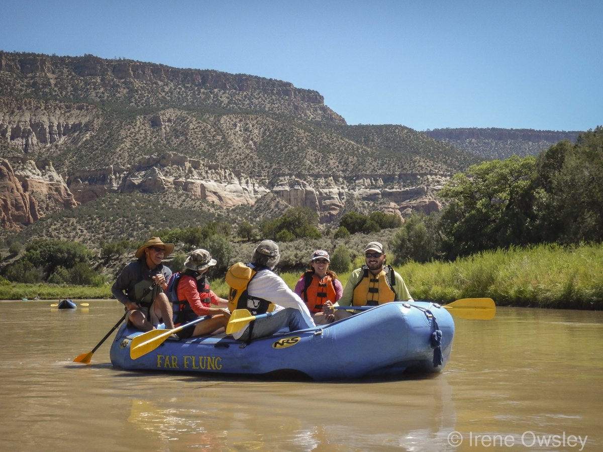
Still, the Chama is best known for its whitewater opportunities. The Chama wilderness run is simply one of the best multiday whitewater voyages in the entire Southwest. The run is a mix of slack water and Class II and III rapids.
Below El Vado Dam, the Chama is extremely popular with paddlers. Private boaters may float the Chama downstream from the Christ in the Desert Monastery, between Chavez Canyon and Big Eddy, without a permit. However, overnight trips between Cooper's El Vado Ranch, located immediately downstream of El Vado Dam, and Chavez Canyon require a river permit from the BLM Taos office, which is run through an on-line lottery system. Demand is high and permits are increasingly difficult to obtain. Cooper's El Vado Ranch also charges a user fee for river access.
The popularity of the Chama means that this section of the river can be crowded at times, making it necessary for boaters to not only watch out for one another but to exercise patience and generosity.
The Chama can be quite cold and swift, especially in the spring. Boaters are cautioned to be aware that hypothermia is a significant risk.
The lower 8 miles of this segment include two campgrounds in addition to the Chavez Canyon and Big Eddy river access sites and a dirt road paralleling the river that provides for easy access under dry conditions. A Benedictine monastery, Christ in the Desert, is located at the southern end of the Chama canyon 15 miles up the same dirt road.