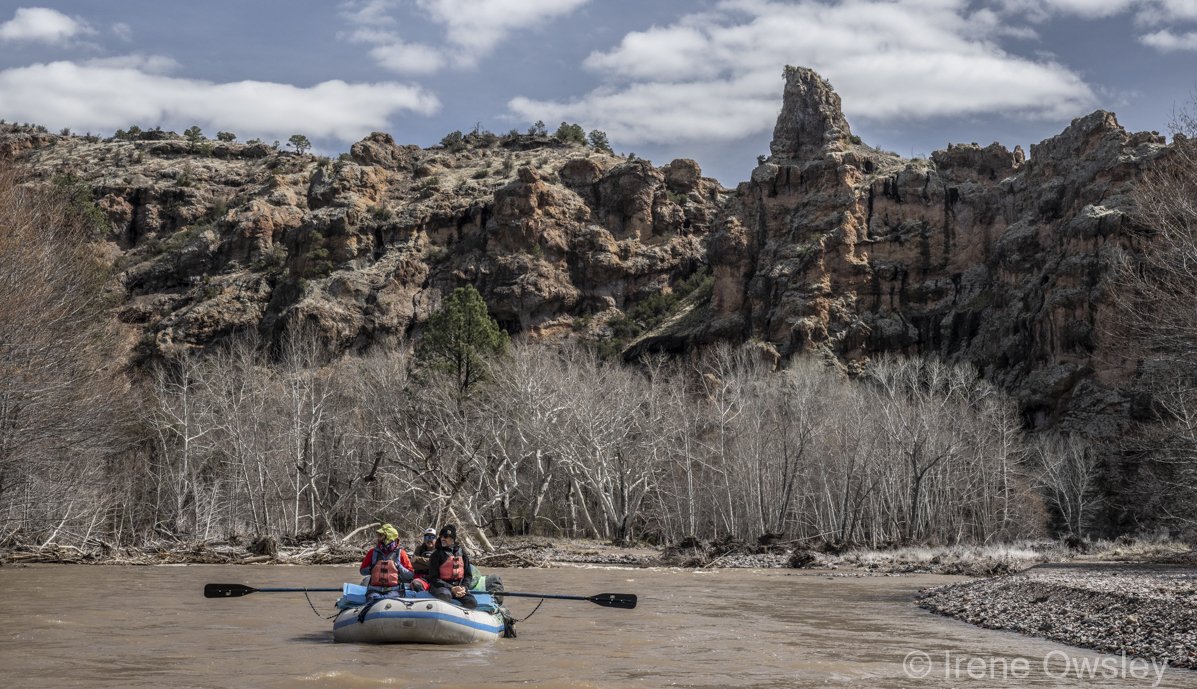
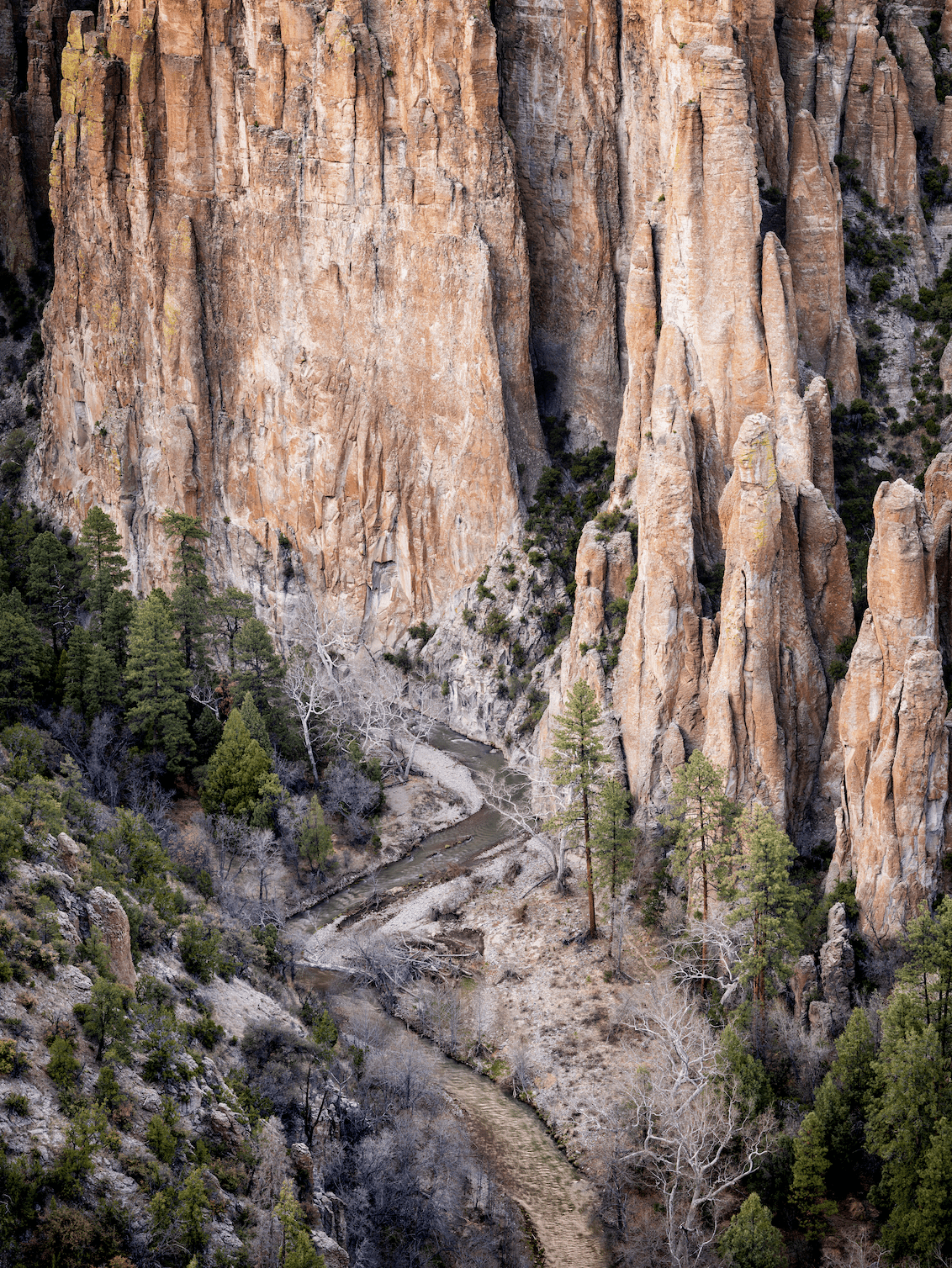
The geology of the Middle Fork of the Gila River, part of the 35 million-year-old Mogollon-Datil volcanic field, is nothing short of astounding. Hiking the Middle Fork is akin to melding into a wonderland of spires, volcanic columns, hoodoos, jagged 1,000-foot-high cliffs, rhyolite rock walls, narrow passages, and caves all mirrored in the winding river. Every bend in the river offers a fresh delight.
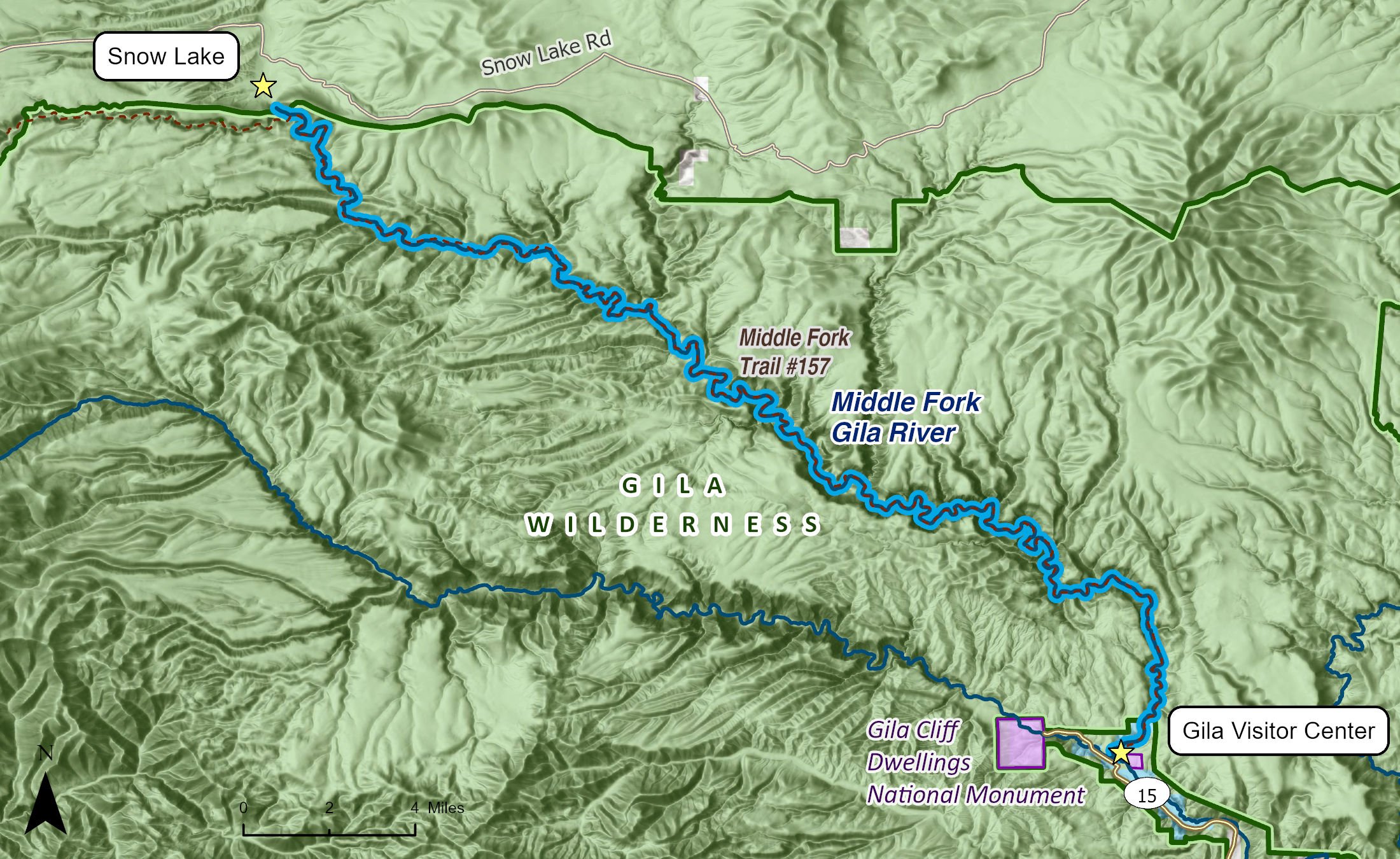
In addition to Snow Lake, the Middle Fork is fed by several main tributaries on the northern edge of the Gila Wilderness: Iron Creek, Gilita Creek, and Willow Creek. The Middle Fork flows southeast, meeting the West Fork of the Gila River 37 miles later, not far from the Gila Cliff Dwellings National Monument. The West Fork then merges with the Gila's East Fork a few miles downstream at Grapevine Campground, forming the mainstem of the Gila River. This is a wild and free-flowing network of rivers uninterrupted by diversions, impoundments, damming, straightening, riprapping, or other common stream modifications.
The Gila is the largest complex of mountain wilderness in North America south of the Greater Yellowstone ecosystem. It is abundantly rich in wildlife thanks in part to the relative wildness of the landscape. In addition, this region is where the Nearctic and Neotropical ecosystems overlap and a great mixing and diversity of species proliferates across the landscape.
Through the course of its flow, the Middle Fork descends over 1,600 feet and is fed along the way by numerous side canyons and creeks, including Little Bear Canyon, Big Bear Canyon, Jordan Canyon, Indian Creek Canyon, Flying V Canyon, Clayton Creek, Gilita Creek, and Iron Creek.
The Middle Fork is generally non-navigable although some adventurers will occasionally packraft some of the lower sections during exceptional spring runoff. These flow events are rare and typically persist for a very short time. Class II rapids are the general rule along the Middle Fork but the prevalence of trees and branches in the channel create dangerous strainers that can pin a boater. Spring runoff and flash floods, exacerbated by recent wildfires higher in the watershed, reshape the river regularly. Scouting, strong expedition paddling skills, and planning ahead are vital to packraft this segment.
Hiking, backpacking, horseback riding, pack mule trips, and world-class fishing are more common activities along the river. These are some of the most remote and wildest protected public lands in the lower 48. Thus, the Middle Fork offers endless opportunity for solitude and primitive recreation among its canyons and in the iconic ponderosa pine forests in the surrounding uplands.
Rich with native fish, the Middle Fork of the Gila provides excellent habitat for the federally endangered loach minnow and spikedace as well as, in its far upper reaches, several trout species including the threatened Gila trout. In recent years, there has been an explosion in beaver activity in the Middle Fork, and new ponds along with other traces of their handiwork can be found throughout the canyon.